You are here: Home > Network List > US - United States National Seismic Network Stations List
> Station WVOR Wild Horse Valley, Oregon, USA > Earthquake Result Viewer
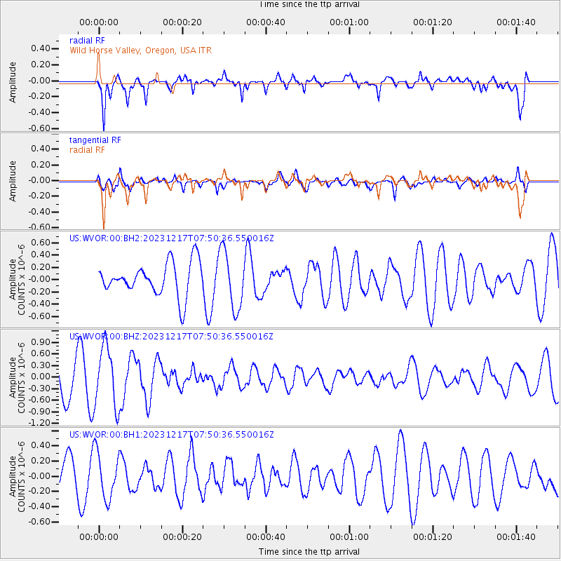
WVOR Wild Horse Valley, Oregon, USA - Earthquake Result Viewer
*The percent match for this event was below the threshold and hence no stack was calculated.
| Earthquake location: |
Southeast Of Loyalty Islands |
| Earthquake latitude/longitude: |
-21.6/169.2 |
| Earthquake time(UTC): |
2023/12/17 (351) 07:37:59 GMT |
| Earthquake Depth: |
10 km |
| Earthquake Magnitude: |
5.7 Mww |
| Earthquake Catalog/Contributor: |
NEIC PDE/us |
|
| Network: |
US United States National Seismic Network |
| Station: |
WVOR Wild Horse Valley, Oregon, USA |
| Lat/Lon: |
42.43 N/118.64 W |
| Elevation: |
1344 m |
|
| Distance: |
92.0 deg |
| Az: |
44.852 deg |
| Baz: |
242.467 deg |
| Ray Param: |
$rayparam |
*The percent match for this event was below the threshold and hence was not used in the summary stack. |
|
| Radial Match: |
79.7092 % |
| Radial Bump: |
400 |
| Transverse Match: |
68.1859 % |
| Transverse Bump: |
400 |
| SOD ConfigId: |
33437571 |
| Insert Time: |
2023-12-31 07:53:37.847 +0000 |
| GWidth: |
2.5 |
| Max Bumps: |
400 |
| Tol: |
0.001 |
|
Signal To Noise
| Channel | StoN | STA | LTA |
| US:WVOR:00:BHZ:20231217T07:50:36.550016Z | 1.9958295 | 7.804034E-7 | 3.9101707E-7 |
| US:WVOR:00:BH1:20231217T07:50:36.550016Z | 1.1724373 | 2.961222E-7 | 2.5256975E-7 |
| US:WVOR:00:BH2:20231217T07:50:36.550016Z | 1.7709605 | 4.758415E-7 | 2.686912E-7 |
| Arrivals |
| Ps | |
| PpPs | |
| PsPs/PpSs | |


