You are here: Home > Network List > TA - USArray Transportable Network (new EarthScope stations) Stations List
> Station J34A George, IA, USA > Earthquake Result Viewer
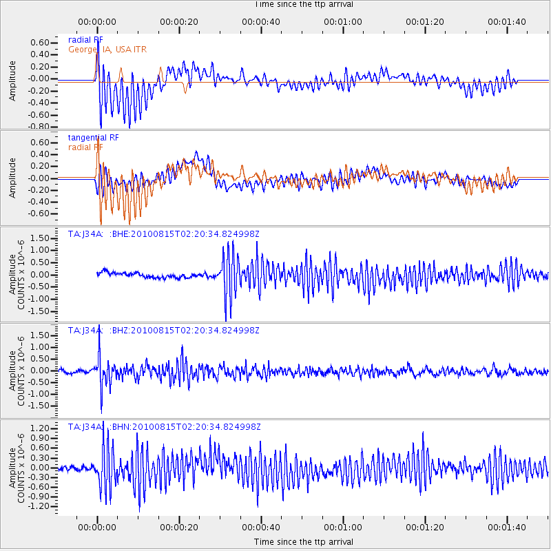
J34A George, IA, USA - Earthquake Result Viewer
*The percent match for this event was below the threshold and hence no stack was calculated.
| Earthquake location: |
Near East Coast Of Kamchatka |
| Earthquake latitude/longitude: |
53.6/160.1 |
| Earthquake time(UTC): |
2010/08/15 (227) 02:10:38 GMT |
| Earthquake Depth: |
40 km |
| Earthquake Magnitude: |
5.5 MB, 4.9 MS, 5.5 MW, 5.4 MW |
| Earthquake Catalog/Contributor: |
WHDF/NEIC |
|
| Network: |
TA USArray Transportable Network (new EarthScope stations) |
| Station: |
J34A George, IA, USA |
| Lat/Lon: |
43.28 N/95.96 W |
| Elevation: |
432 m |
|
| Distance: |
63.7 deg |
| Az: |
52.262 deg |
| Baz: |
319.753 deg |
| Ray Param: |
$rayparam |
*The percent match for this event was below the threshold and hence was not used in the summary stack. |
|
| Radial Match: |
74.068535 % |
| Radial Bump: |
400 |
| Transverse Match: |
60.464504 % |
| Transverse Bump: |
400 |
| SOD ConfigId: |
319893 |
| Insert Time: |
2011-01-05 23:44:58.911 +0000 |
| GWidth: |
2.5 |
| Max Bumps: |
400 |
| Tol: |
0.001 |
|
Signal To Noise
| Channel | StoN | STA | LTA |
| TA:J34A: :BHZ:20100815T02:20:34.824998Z | 6.749992 | 6.220641E-7 | 9.2157755E-8 |
| TA:J34A: :BHN:20100815T02:20:34.824998Z | 8.415108 | 6.1707584E-7 | 7.3329524E-8 |
| TA:J34A: :BHE:20100815T02:20:34.824998Z | 8.418407 | 8.328039E-7 | 9.8926535E-8 |
| Arrivals |
| Ps | |
| PpPs | |
| PsPs/PpSs | |


