You are here: Home > Network List > US - United States National Seismic Network Stations List
> Station HAWA Hanford, Washington, USA > Earthquake Result Viewer
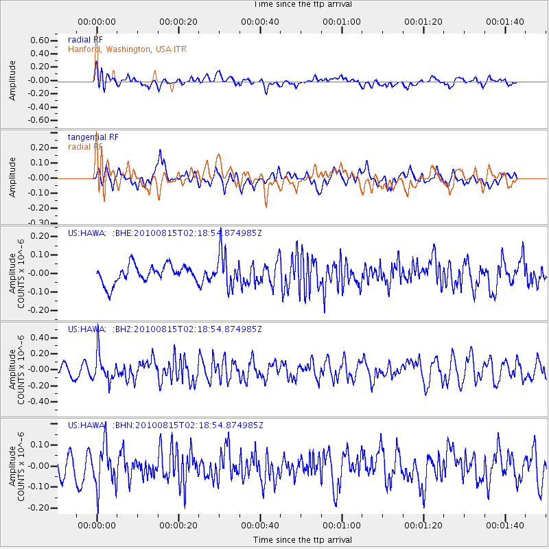
HAWA Hanford, Washington, USA - Earthquake Result Viewer
*The percent match for this event was below the threshold and hence no stack was calculated.
| Earthquake location: |
Near East Coast Of Kamchatka |
| Earthquake latitude/longitude: |
53.6/160.1 |
| Earthquake time(UTC): |
2010/08/15 (227) 02:10:38 GMT |
| Earthquake Depth: |
40 km |
| Earthquake Magnitude: |
5.5 MB, 4.9 MS, 5.5 MW, 5.4 MW |
| Earthquake Catalog/Contributor: |
WHDF/NEIC |
|
| Network: |
US United States National Seismic Network |
| Station: |
HAWA Hanford, Washington, USA |
| Lat/Lon: |
46.39 N/119.53 W |
| Elevation: |
364 m |
|
| Distance: |
49.6 deg |
| Az: |
63.685 deg |
| Baz: |
309.408 deg |
| Ray Param: |
$rayparam |
*The percent match for this event was below the threshold and hence was not used in the summary stack. |
|
| Radial Match: |
58.106262 % |
| Radial Bump: |
400 |
| Transverse Match: |
49.89755 % |
| Transverse Bump: |
400 |
| SOD ConfigId: |
319893 |
| Insert Time: |
2011-01-05 23:47:48.127 +0000 |
| GWidth: |
2.5 |
| Max Bumps: |
400 |
| Tol: |
0.001 |
|
Signal To Noise
| Channel | StoN | STA | LTA |
| US:HAWA: :BHZ:20100815T02:18:54.874985Z | 2.750805 | 1.7771625E-7 | 6.460518E-8 |
| US:HAWA: :BHN:20100815T02:18:54.874985Z | 2.141105 | 1.0125817E-7 | 4.7292488E-8 |
| US:HAWA: :BHE:20100815T02:18:54.874985Z | 1.9842556 | 9.59342E-8 | 4.8347705E-8 |
| Arrivals |
| Ps | |
| PpPs | |
| PsPs/PpSs | |


