You are here: Home > Network List > US - United States National Seismic Network Stations List
> Station DGMT Dagmar, Montana, USA > Earthquake Result Viewer
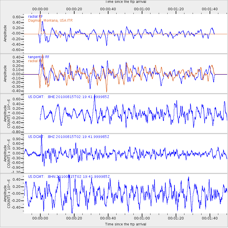
DGMT Dagmar, Montana, USA - Earthquake Result Viewer
*The percent match for this event was below the threshold and hence no stack was calculated.
| Earthquake location: |
Near East Coast Of Kamchatka |
| Earthquake latitude/longitude: |
53.6/160.1 |
| Earthquake time(UTC): |
2010/08/15 (227) 02:10:38 GMT |
| Earthquake Depth: |
40 km |
| Earthquake Magnitude: |
5.5 MB, 4.9 MS, 5.5 MW, 5.4 MW |
| Earthquake Catalog/Contributor: |
WHDF/NEIC |
|
| Network: |
US United States National Seismic Network |
| Station: |
DGMT Dagmar, Montana, USA |
| Lat/Lon: |
48.47 N/104.20 W |
| Elevation: |
0.0 m |
|
| Distance: |
56.0 deg |
| Az: |
53.046 deg |
| Baz: |
314.243 deg |
| Ray Param: |
$rayparam |
*The percent match for this event was below the threshold and hence was not used in the summary stack. |
|
| Radial Match: |
57.70801 % |
| Radial Bump: |
400 |
| Transverse Match: |
67.67832 % |
| Transverse Bump: |
400 |
| SOD ConfigId: |
319893 |
| Insert Time: |
2011-01-05 23:48:36.570 +0000 |
| GWidth: |
2.5 |
| Max Bumps: |
400 |
| Tol: |
0.001 |
|
Signal To Noise
| Channel | StoN | STA | LTA |
| US:DGMT: :BHZ:20100815T02:19:41.999985Z | 3.803296 | 3.7956386E-7 | 9.979866E-8 |
| US:DGMT: :BHN:20100815T02:19:41.999985Z | 1.0696719 | 1.7844002E-7 | 1.6681753E-7 |
| US:DGMT: :BHE:20100815T02:19:41.999985Z | 1.6997253 | 3.2418336E-7 | 1.9072691E-7 |
| Arrivals |
| Ps | |
| PpPs | |
| PsPs/PpSs | |


