You are here: Home > Network List > UW - Pacific Northwest Regional Seismic Network Stations List
> Station PASS Maple Falls, WA, USA > Earthquake Result Viewer
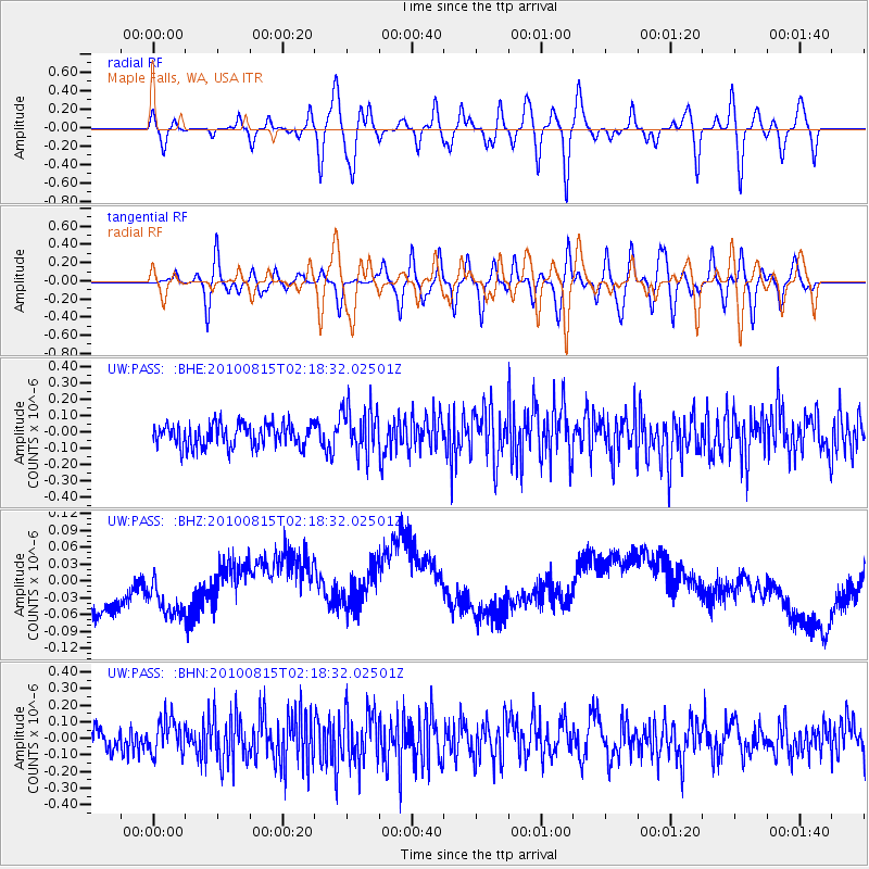
PASS Maple Falls, WA, USA - Earthquake Result Viewer
*The percent match for this event was below the threshold and hence no stack was calculated.
| Earthquake location: |
Near East Coast Of Kamchatka |
| Earthquake latitude/longitude: |
53.6/160.1 |
| Earthquake time(UTC): |
2010/08/15 (227) 02:10:38 GMT |
| Earthquake Depth: |
40 km |
| Earthquake Magnitude: |
5.5 MB, 4.9 MS, 5.5 MW, 5.4 MW |
| Earthquake Catalog/Contributor: |
WHDF/NEIC |
|
| Network: |
UW Pacific Northwest Regional Seismic Network |
| Station: |
PASS Maple Falls, WA, USA |
| Lat/Lon: |
49.00 N/122.09 W |
| Elevation: |
174 m |
|
| Distance: |
46.6 deg |
| Az: |
62.353 deg |
| Baz: |
306.635 deg |
| Ray Param: |
$rayparam |
*The percent match for this event was below the threshold and hence was not used in the summary stack. |
|
| Radial Match: |
45.99994 % |
| Radial Bump: |
400 |
| Transverse Match: |
46.76508 % |
| Transverse Bump: |
400 |
| SOD ConfigId: |
319893 |
| Insert Time: |
2011-01-05 23:50:22.812 +0000 |
| GWidth: |
2.5 |
| Max Bumps: |
400 |
| Tol: |
0.001 |
|
Signal To Noise
| Channel | StoN | STA | LTA |
| UW:PASS: :BHZ:20100815T02:18:32.02501Z | 0.9252671 | 8.9153154E-8 | 9.635397E-8 |
| UW:PASS: :BHN:20100815T02:18:32.02501Z | 1.5319769 | 1.0363457E-7 | 6.7647605E-8 |
| UW:PASS: :BHE:20100815T02:18:32.02501Z | 2.1184933 | 1.4687383E-7 | 6.9329374E-8 |
| Arrivals |
| Ps | |
| PpPs | |
| PsPs/PpSs | |


