You are here: Home > Network List > IU - Global Seismograph Network (GSN - IRIS/USGS) Stations List
> Station JOHN Johnston Island, USA > Earthquake Result Viewer
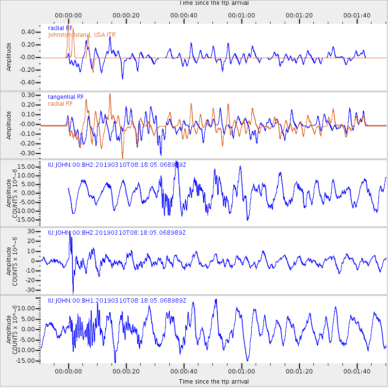
JOHN Johnston Island, USA - Earthquake Result Viewer
*The percent match for this event was below the threshold and hence no stack was calculated.
| Earthquake location: |
Fiji Islands Region |
| Earthquake latitude/longitude: |
-17.8/-178.7 |
| Earthquake time(UTC): |
2019/03/10 (069) 08:12:25 GMT |
| Earthquake Depth: |
567 km |
| Earthquake Magnitude: |
6.2 Mww |
| Earthquake Catalog/Contributor: |
NEIC PDE/us |
|
| Network: |
IU Global Seismograph Network (GSN - IRIS/USGS) |
| Station: |
JOHN Johnston Island, USA |
| Lat/Lon: |
16.73 N/169.53 W |
| Elevation: |
2.0 m |
|
| Distance: |
35.5 deg |
| Az: |
15.181 deg |
| Baz: |
195.09 deg |
| Ray Param: |
$rayparam |
*The percent match for this event was below the threshold and hence was not used in the summary stack. |
|
| Radial Match: |
49.80188 % |
| Radial Bump: |
400 |
| Transverse Match: |
47.91012 % |
| Transverse Bump: |
400 |
| SOD ConfigId: |
3338192 |
| Insert Time: |
2019-03-24 08:30:17.664 +0000 |
| GWidth: |
2.5 |
| Max Bumps: |
400 |
| Tol: |
0.001 |
|
Signal To Noise
| Channel | StoN | STA | LTA |
| IU:JOHN:00:BHZ:20190310T08:18:05.068989Z | 3.208323 | 1.2536762E-5 | 3.907575E-6 |
| IU:JOHN:00:BH1:20190310T08:18:05.068989Z | 1.1607188 | 4.1228227E-6 | 3.5519565E-6 |
| IU:JOHN:00:BH2:20190310T08:18:05.068989Z | 1.0602145 | 5.2810688E-6 | 4.9811324E-6 |
| Arrivals |
| Ps | |
| PpPs | |
| PsPs/PpSs | |


