You are here: Home > Network List > CI - Caltech Regional Seismic Network Stations List
> Station MPP McPhearson Peak > Earthquake Result Viewer
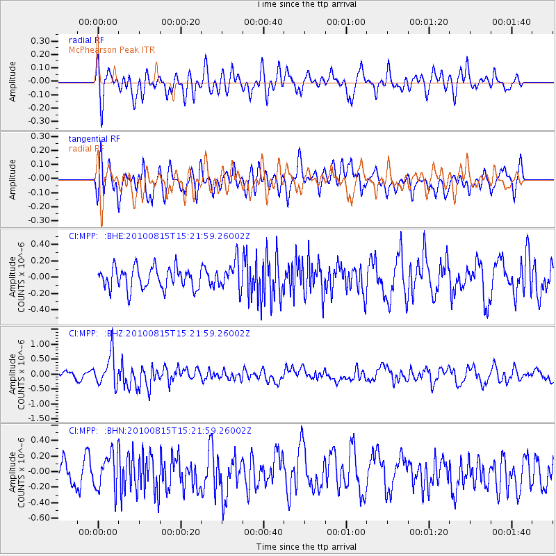
MPP McPhearson Peak - Earthquake Result Viewer
*The percent match for this event was below the threshold and hence no stack was calculated.
| Earthquake location: |
New Britain Region, P.N.G. |
| Earthquake latitude/longitude: |
-5.7/148.3 |
| Earthquake time(UTC): |
2010/08/15 (227) 15:09:29 GMT |
| Earthquake Depth: |
175 km |
| Earthquake Magnitude: |
5.8 MB, 6.3 MW, 6.3 MW |
| Earthquake Catalog/Contributor: |
WHDF/NEIC |
|
| Network: |
CI Caltech Regional Seismic Network |
| Station: |
MPP McPhearson Peak |
| Lat/Lon: |
34.89 N/119.81 W |
| Elevation: |
1739 m |
|
| Distance: |
94.7 deg |
| Az: |
55.532 deg |
| Baz: |
266.39 deg |
| Ray Param: |
$rayparam |
*The percent match for this event was below the threshold and hence was not used in the summary stack. |
|
| Radial Match: |
68.67337 % |
| Radial Bump: |
400 |
| Transverse Match: |
53.526073 % |
| Transverse Bump: |
400 |
| SOD ConfigId: |
319893 |
| Insert Time: |
2011-01-05 23:58:31.757 +0000 |
| GWidth: |
2.5 |
| Max Bumps: |
400 |
| Tol: |
0.001 |
|
Signal To Noise
| Channel | StoN | STA | LTA |
| CI:MPP: :BHZ:20100815T15:21:59.26002Z | 4.6906962 | 5.4987447E-7 | 1.1722662E-7 |
| CI:MPP: :BHN:20100815T15:21:59.26002Z | 1.5172672 | 2.3409824E-7 | 1.542894E-7 |
| CI:MPP: :BHE:20100815T15:21:59.26002Z | 1.332123 | 1.7357618E-7 | 1.3030042E-7 |
| Arrivals |
| Ps | |
| PpPs | |
| PsPs/PpSs | |


