You are here: Home > Network List > TA - USArray Transportable Network (new EarthScope stations) Stations List
> Station J01D Myrtle Point, OR, USA > Earthquake Result Viewer
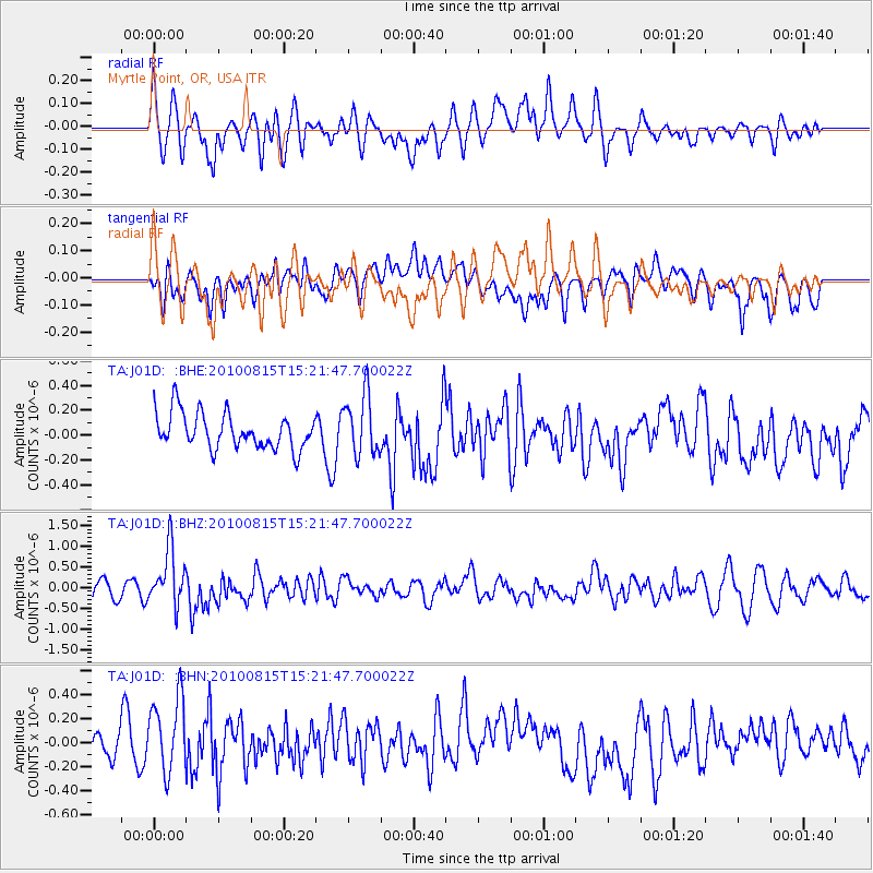
J01D Myrtle Point, OR, USA - Earthquake Result Viewer
*The percent match for this event was below the threshold and hence no stack was calculated.
| Earthquake location: |
New Britain Region, P.N.G. |
| Earthquake latitude/longitude: |
-5.7/148.3 |
| Earthquake time(UTC): |
2010/08/15 (227) 15:09:29 GMT |
| Earthquake Depth: |
175 km |
| Earthquake Magnitude: |
5.8 MB, 6.3 MW, 6.3 MW |
| Earthquake Catalog/Contributor: |
WHDF/NEIC |
|
| Network: |
TA USArray Transportable Network (new EarthScope stations) |
| Station: |
J01D Myrtle Point, OR, USA |
| Lat/Lon: |
43.16 N/123.93 W |
| Elevation: |
131 m |
|
| Distance: |
92.2 deg |
| Az: |
47.027 deg |
| Baz: |
264.314 deg |
| Ray Param: |
$rayparam |
*The percent match for this event was below the threshold and hence was not used in the summary stack. |
|
| Radial Match: |
54.665943 % |
| Radial Bump: |
400 |
| Transverse Match: |
47.94448 % |
| Transverse Bump: |
400 |
| SOD ConfigId: |
319893 |
| Insert Time: |
2011-01-06 00:04:58.568 +0000 |
| GWidth: |
2.5 |
| Max Bumps: |
400 |
| Tol: |
0.001 |
|
Signal To Noise
| Channel | StoN | STA | LTA |
| TA:J01D: :BHZ:20100815T15:21:47.700022Z | 3.27845 | 6.882653E-7 | 2.0993619E-7 |
| TA:J01D: :BHN:20100815T15:21:47.700022Z | 2.244735 | 3.3656966E-7 | 1.4993736E-7 |
| TA:J01D: :BHE:20100815T15:21:47.700022Z | 1.6907725 | 2.4143532E-7 | 1.4279586E-7 |
| Arrivals |
| Ps | |
| PpPs | |
| PsPs/PpSs | |


