You are here: Home > Network List > IW - Intermountain West Stations List
> Station MOOW Moose Ponds, Wyoming, USA > Earthquake Result Viewer
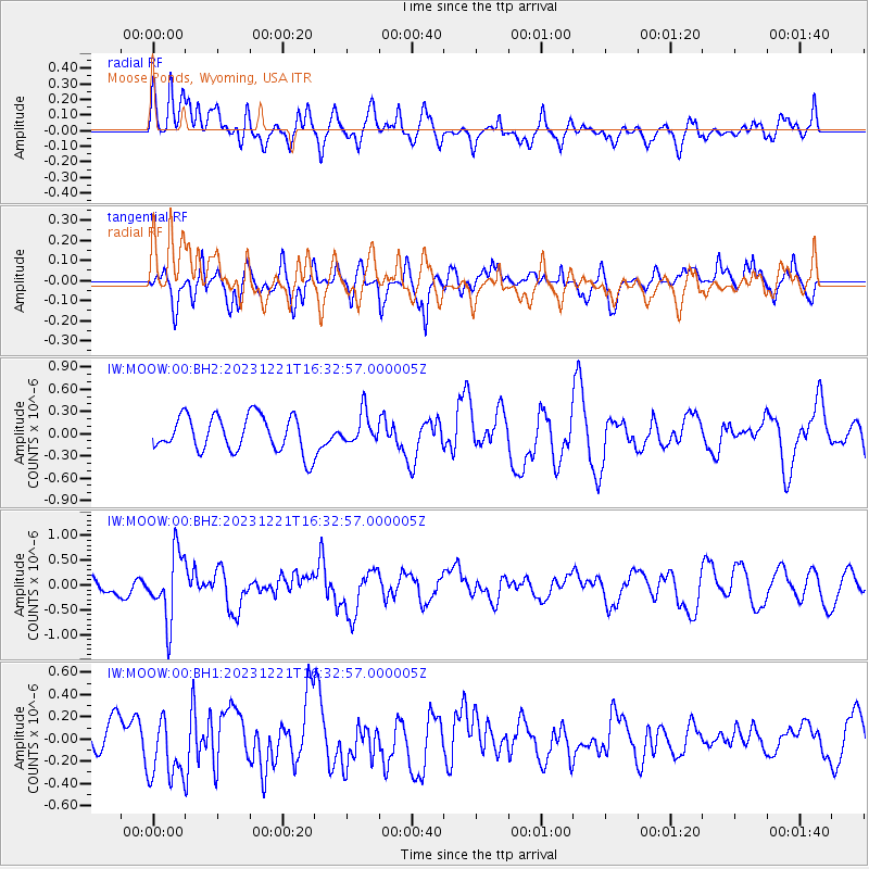
MOOW Moose Ponds, Wyoming, USA - Earthquake Result Viewer
*The percent match for this event was below the threshold and hence no stack was calculated.
| Earthquake location: |
Near Coast Of Northern Chile |
| Earthquake latitude/longitude: |
-21.9/-70.1 |
| Earthquake time(UTC): |
2023/12/21 (355) 16:21:52 GMT |
| Earthquake Depth: |
63 km |
| Earthquake Magnitude: |
5.6 mww |
| Earthquake Catalog/Contributor: |
NEIC PDE/us |
|
| Network: |
IW Intermountain West |
| Station: |
MOOW Moose Ponds, Wyoming, USA |
| Lat/Lon: |
43.75 N/110.74 W |
| Elevation: |
2128 m |
|
| Distance: |
75.2 deg |
| Az: |
330.807 deg |
| Baz: |
141.317 deg |
| Ray Param: |
$rayparam |
*The percent match for this event was below the threshold and hence was not used in the summary stack. |
|
| Radial Match: |
66.00483 % |
| Radial Bump: |
400 |
| Transverse Match: |
62.01194 % |
| Transverse Bump: |
400 |
| SOD ConfigId: |
33437571 |
| Insert Time: |
2024-01-04 16:35:38.801 +0000 |
| GWidth: |
2.5 |
| Max Bumps: |
400 |
| Tol: |
0.001 |
|
Signal To Noise
| Channel | StoN | STA | LTA |
| IW:MOOW:00:BHZ:20231221T16:32:57.000005Z | 2.6987882 | 6.7139894E-7 | 2.4877792E-7 |
| IW:MOOW:00:BH1:20231221T16:32:57.000005Z | 1.6844833 | 3.126122E-7 | 1.8558343E-7 |
| IW:MOOW:00:BH2:20231221T16:32:57.000005Z | 0.8657224 | 2.0950044E-7 | 2.419949E-7 |
| Arrivals |
| Ps | |
| PpPs | |
| PsPs/PpSs | |


