You are here: Home > Network List > US - United States National Seismic Network Stations List
> Station EGMT Eagleton, Montana, USA > Earthquake Result Viewer
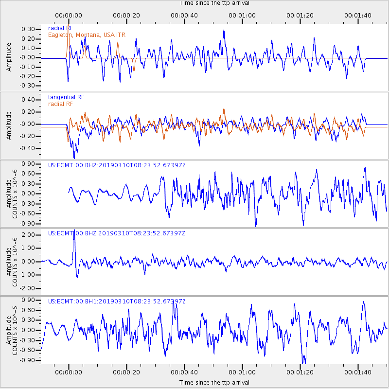
EGMT Eagleton, Montana, USA - Earthquake Result Viewer
*The percent match for this event was below the threshold and hence no stack was calculated.
| Earthquake location: |
Fiji Islands Region |
| Earthquake latitude/longitude: |
-17.8/-178.7 |
| Earthquake time(UTC): |
2019/03/10 (069) 08:12:25 GMT |
| Earthquake Depth: |
567 km |
| Earthquake Magnitude: |
6.2 Mww |
| Earthquake Catalog/Contributor: |
NEIC PDE/us |
|
| Network: |
US United States National Seismic Network |
| Station: |
EGMT Eagleton, Montana, USA |
| Lat/Lon: |
48.02 N/109.75 W |
| Elevation: |
1055 m |
|
| Distance: |
89.7 deg |
| Az: |
38.78 deg |
| Baz: |
242.716 deg |
| Ray Param: |
$rayparam |
*The percent match for this event was below the threshold and hence was not used in the summary stack. |
|
| Radial Match: |
55.944065 % |
| Radial Bump: |
400 |
| Transverse Match: |
64.732346 % |
| Transverse Bump: |
400 |
| SOD ConfigId: |
3338192 |
| Insert Time: |
2019-03-24 08:33:22.643 +0000 |
| GWidth: |
2.5 |
| Max Bumps: |
400 |
| Tol: |
0.001 |
|
Signal To Noise
| Channel | StoN | STA | LTA |
| US:EGMT:00:BHZ:20190310T08:23:52.67397Z | 3.5945823 | 8.256976E-7 | 2.2970613E-7 |
| US:EGMT:00:BH1:20190310T08:23:52.67397Z | 0.5571704 | 1.8766866E-7 | 3.3682457E-7 |
| US:EGMT:00:BH2:20190310T08:23:52.67397Z | 2.714892 | 3.5473911E-7 | 1.3066418E-7 |
| Arrivals |
| Ps | |
| PpPs | |
| PsPs/PpSs | |


