You are here: Home > Network List > US - United States National Seismic Network Stations List
> Station HAWA Hanford, Washington, USA > Earthquake Result Viewer
HAWA Hanford, Washington, USA - Earthquake Result Viewer
*The percent match for this event was below the threshold and hence no stack was calculated.
| Earthquake location: |
Near Coast Of Northern Chile |
| Earthquake latitude/longitude: |
-21.9/-70.1 |
| Earthquake time(UTC): |
2023/12/21 (355) 16:21:52 GMT |
| Earthquake Depth: |
63 km |
| Earthquake Magnitude: |
5.6 mww |
| Earthquake Catalog/Contributor: |
NEIC PDE/us |
|
| Network: |
US United States National Seismic Network |
| Station: |
HAWA Hanford, Washington, USA |
| Lat/Lon: |
46.39 N/119.53 W |
| Elevation: |
364 m |
|
| Distance: |
81.3 deg |
| Az: |
327.896 deg |
| Baz: |
134.515 deg |
| Ray Param: |
$rayparam |
*The percent match for this event was below the threshold and hence was not used in the summary stack. |
|
| Radial Match: |
45.248665 % |
| Radial Bump: |
400 |
| Transverse Match: |
48.08102 % |
| Transverse Bump: |
400 |
| SOD ConfigId: |
33437571 |
| Insert Time: |
2024-01-04 16:51:42.830 +0000 |
| GWidth: |
2.5 |
| Max Bumps: |
400 |
| Tol: |
0.001 |
|
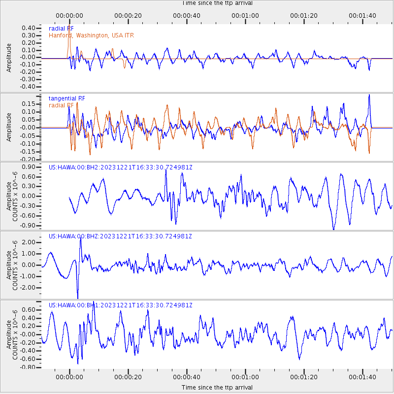
Signal To Noise
| Channel | StoN | STA | LTA |
| US:HAWA:00:BHZ:20231221T16:33:30.724981Z | 2.2724538 | 1.1439919E-6 | 5.03417E-7 |
| US:HAWA:00:BH1:20231221T16:33:30.724981Z | 1.2929614 | 3.9924538E-7 | 3.0878368E-7 |
| US:HAWA:00:BH2:20231221T16:33:30.724981Z | 1.0539501 | 2.7243894E-7 | 2.5849323E-7 |
| Arrivals |
| Ps | |
| PpPs | |
| PsPs/PpSs | |


