You are here: Home > Network List > CI - Caltech Regional Seismic Network Stations List
> Station DAN Danby, California, USA > Earthquake Result Viewer
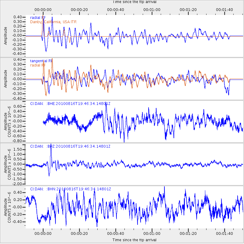
DAN Danby, California, USA - Earthquake Result Viewer
*The percent match for this event was below the threshold and hence no stack was calculated.
| Earthquake location: |
Fiji Islands Region |
| Earthquake latitude/longitude: |
-20.8/-178.8 |
| Earthquake time(UTC): |
2010/08/16 (228) 19:35:49 GMT |
| Earthquake Depth: |
603 km |
| Earthquake Magnitude: |
5.7 MB, 6.2 MW, 6.1 MW |
| Earthquake Catalog/Contributor: |
WHDF/NEIC |
|
| Network: |
CI Caltech Regional Seismic Network |
| Station: |
DAN Danby, California, USA |
| Lat/Lon: |
34.64 N/115.38 W |
| Elevation: |
398 m |
|
| Distance: |
81.7 deg |
| Az: |
48.199 deg |
| Baz: |
237.766 deg |
| Ray Param: |
$rayparam |
*The percent match for this event was below the threshold and hence was not used in the summary stack. |
|
| Radial Match: |
76.4792 % |
| Radial Bump: |
400 |
| Transverse Match: |
48.141533 % |
| Transverse Bump: |
400 |
| SOD ConfigId: |
319893 |
| Insert Time: |
2011-01-06 00:17:29.617 +0000 |
| GWidth: |
2.5 |
| Max Bumps: |
400 |
| Tol: |
0.001 |
|
Signal To Noise
| Channel | StoN | STA | LTA |
| CI:DAN: :BHZ:20100816T19:46:34.14801Z | 5.8976045 | 6.762307E-7 | 1.1466192E-7 |
| CI:DAN: :BHN:20100816T19:46:34.14801Z | 2.060078 | 3.0831197E-7 | 1.4966034E-7 |
| CI:DAN: :BHE:20100816T19:46:34.14801Z | 2.0546746 | 3.3012998E-7 | 1.6067263E-7 |
| Arrivals |
| Ps | |
| PpPs | |
| PsPs/PpSs | |


