You are here: Home > Network List > GS - US Geological Survey Networks Stations List
> Station KAN10 Keim Farm > Earthquake Result Viewer
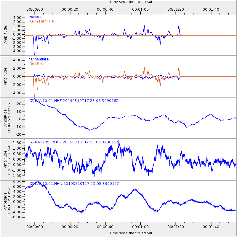
KAN10 Keim Farm - Earthquake Result Viewer
*The percent match for this event was below the threshold and hence no stack was calculated.
| Earthquake location: |
Off East Coast Of Honshu, Japan |
| Earthquake latitude/longitude: |
36.9/142.4 |
| Earthquake time(UTC): |
2019/03/10 (069) 17:10:52 GMT |
| Earthquake Depth: |
15 km |
| Earthquake Magnitude: |
5.8 Mww |
| Earthquake Catalog/Contributor: |
NEIC PDE/us |
|
| Network: |
GS US Geological Survey Networks |
| Station: |
KAN10 Keim Farm |
| Lat/Lon: |
37.12 N/98.10 W |
| Elevation: |
417 m |
|
| Distance: |
87.5 deg |
| Az: |
44.111 deg |
| Baz: |
315.692 deg |
| Ray Param: |
$rayparam |
*The percent match for this event was below the threshold and hence was not used in the summary stack. |
|
| Radial Match: |
87.608864 % |
| Radial Bump: |
258 |
| Transverse Match: |
82.41426 % |
| Transverse Bump: |
307 |
| SOD ConfigId: |
3338192 |
| Insert Time: |
2019-03-24 17:22:10.922 +0000 |
| GWidth: |
2.5 |
| Max Bumps: |
400 |
| Tol: |
0.001 |
|
Signal To Noise
| Channel | StoN | STA | LTA |
| GS:KAN10:01:HHZ:20190310T17:23:08.399016Z | 1.0236734 | 1.2757482E-6 | 1.2462453E-6 |
| GS:KAN10:01:HHN:20190310T17:23:08.399016Z | 2.1414993 | 1.4328258E-5 | 6.6907605E-6 |
| GS:KAN10:01:HHE:20190310T17:23:08.399016Z | 2.3305058 | 2.312485E-5 | 9.9226745E-6 |
| Arrivals |
| Ps | |
| PpPs | |
| PsPs/PpSs | |


