You are here: Home > Network List > TA - USArray Transportable Network (new EarthScope stations) Stations List
> Station 532A Rocksprings, TX, USA > Earthquake Result Viewer
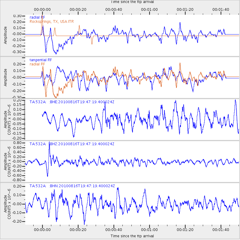
532A Rocksprings, TX, USA - Earthquake Result Viewer
*The percent match for this event was below the threshold and hence no stack was calculated.
| Earthquake location: |
Fiji Islands Region |
| Earthquake latitude/longitude: |
-20.8/-178.8 |
| Earthquake time(UTC): |
2010/08/16 (228) 19:35:49 GMT |
| Earthquake Depth: |
603 km |
| Earthquake Magnitude: |
5.7 MB, 6.2 MW, 6.1 MW |
| Earthquake Catalog/Contributor: |
WHDF/NEIC |
|
| Network: |
TA USArray Transportable Network (new EarthScope stations) |
| Station: |
532A Rocksprings, TX, USA |
| Lat/Lon: |
30.13 N/99.90 W |
| Elevation: |
703 m |
|
| Distance: |
91.2 deg |
| Az: |
58.255 deg |
| Baz: |
246.69 deg |
| Ray Param: |
$rayparam |
*The percent match for this event was below the threshold and hence was not used in the summary stack. |
|
| Radial Match: |
50.222862 % |
| Radial Bump: |
400 |
| Transverse Match: |
54.299862 % |
| Transverse Bump: |
400 |
| SOD ConfigId: |
319893 |
| Insert Time: |
2011-01-06 00:29:36.554 +0000 |
| GWidth: |
2.5 |
| Max Bumps: |
400 |
| Tol: |
0.001 |
|
Signal To Noise
| Channel | StoN | STA | LTA |
| TA:532A: :BHZ:20100816T19:47:19.400024Z | 4.6159635 | 3.1296585E-7 | 6.780076E-8 |
| TA:532A: :BHN:20100816T19:47:19.400024Z | 1.0702033 | 6.52928E-8 | 6.1009715E-8 |
| TA:532A: :BHE:20100816T19:47:19.400024Z | 1.2512832 | 7.0769154E-8 | 5.6557262E-8 |
| Arrivals |
| Ps | |
| PpPs | |
| PsPs/PpSs | |


