You are here: Home > Network List > TA - USArray Transportable Network (new EarthScope stations) Stations List
> Station 332A Millersview, TX, USA > Earthquake Result Viewer
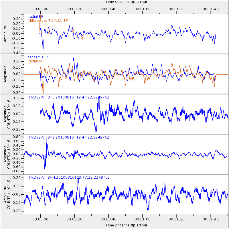
332A Millersview, TX, USA - Earthquake Result Viewer
*The percent match for this event was below the threshold and hence no stack was calculated.
| Earthquake location: |
Fiji Islands Region |
| Earthquake latitude/longitude: |
-20.8/-178.8 |
| Earthquake time(UTC): |
2010/08/16 (228) 19:35:49 GMT |
| Earthquake Depth: |
603 km |
| Earthquake Magnitude: |
5.7 MB, 6.2 MW, 6.1 MW |
| Earthquake Catalog/Contributor: |
WHDF/NEIC |
|
| Network: |
TA USArray Transportable Network (new EarthScope stations) |
| Station: |
332A Millersview, TX, USA |
| Lat/Lon: |
31.38 N/99.74 W |
| Elevation: |
513 m |
|
| Distance: |
91.8 deg |
| Az: |
57.161 deg |
| Baz: |
246.801 deg |
| Ray Param: |
$rayparam |
*The percent match for this event was below the threshold and hence was not used in the summary stack. |
|
| Radial Match: |
60.16804 % |
| Radial Bump: |
400 |
| Transverse Match: |
51.79864 % |
| Transverse Bump: |
400 |
| SOD ConfigId: |
319893 |
| Insert Time: |
2011-01-06 00:30:14.590 +0000 |
| GWidth: |
2.5 |
| Max Bumps: |
400 |
| Tol: |
0.001 |
|
Signal To Noise
| Channel | StoN | STA | LTA |
| TA:332A: :BHZ:20100816T19:47:22.224976Z | 3.038558 | 2.7399682E-7 | 9.01733E-8 |
| TA:332A: :BHN:20100816T19:47:22.224976Z | 0.93309927 | 5.9802765E-8 | 6.4090464E-8 |
| TA:332A: :BHE:20100816T19:47:22.224976Z | 1.8185976 | 1.1900167E-7 | 6.5435955E-8 |
| Arrivals |
| Ps | |
| PpPs | |
| PsPs/PpSs | |


