You are here: Home > Network List > TA - USArray Transportable Network (new EarthScope stations) Stations List
> Station Z32A Haskell, TX, USA > Earthquake Result Viewer
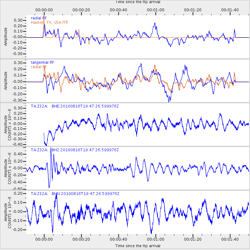
Z32A Haskell, TX, USA - Earthquake Result Viewer
*The percent match for this event was below the threshold and hence no stack was calculated.
| Earthquake location: |
Fiji Islands Region |
| Earthquake latitude/longitude: |
-20.8/-178.8 |
| Earthquake time(UTC): |
2010/08/16 (228) 19:35:49 GMT |
| Earthquake Depth: |
603 km |
| Earthquake Magnitude: |
5.7 MB, 6.2 MW, 6.1 MW |
| Earthquake Catalog/Contributor: |
WHDF/NEIC |
|
| Network: |
TA USArray Transportable Network (new EarthScope stations) |
| Station: |
Z32A Haskell, TX, USA |
| Lat/Lon: |
33.31 N/99.48 W |
| Elevation: |
427 m |
|
| Distance: |
92.8 deg |
| Az: |
55.482 deg |
| Baz: |
247.008 deg |
| Ray Param: |
$rayparam |
*The percent match for this event was below the threshold and hence was not used in the summary stack. |
|
| Radial Match: |
36.966263 % |
| Radial Bump: |
400 |
| Transverse Match: |
29.739592 % |
| Transverse Bump: |
400 |
| SOD ConfigId: |
319893 |
| Insert Time: |
2011-01-06 00:30:27.079 +0000 |
| GWidth: |
2.5 |
| Max Bumps: |
400 |
| Tol: |
0.001 |
|
Signal To Noise
| Channel | StoN | STA | LTA |
| TA:Z32A: :BHZ:20100816T19:47:26.599976Z | 3.016805 | 2.563106E-7 | 8.496095E-8 |
| TA:Z32A: :BHN:20100816T19:47:26.599976Z | 1.1613531 | 1.3179341E-7 | 1.1348264E-7 |
| TA:Z32A: :BHE:20100816T19:47:26.599976Z | 1.083632 | 1.4626404E-7 | 1.3497575E-7 |
| Arrivals |
| Ps | |
| PpPs | |
| PsPs/PpSs | |


