You are here: Home > Network List > US - United States National Seismic Network Stations List
> Station DGMT Dagmar, Montana, USA > Earthquake Result Viewer
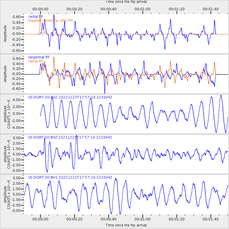
DGMT Dagmar, Montana, USA - Earthquake Result Viewer
*The percent match for this event was below the threshold and hence no stack was calculated.
| Earthquake location: |
Near East Coast Of Kamchatka |
| Earthquake latitude/longitude: |
52.0/159.0 |
| Earthquake time(UTC): |
2023/12/23 (357) 17:48:03 GMT |
| Earthquake Depth: |
29 km |
| Earthquake Magnitude: |
5.8 Mww |
| Earthquake Catalog/Contributor: |
NEIC PDE/us |
|
| Network: |
US United States National Seismic Network |
| Station: |
DGMT Dagmar, Montana, USA |
| Lat/Lon: |
48.47 N/104.20 W |
| Elevation: |
646 m |
|
| Distance: |
57.5 deg |
| Az: |
51.571 deg |
| Baz: |
313.237 deg |
| Ray Param: |
$rayparam |
*The percent match for this event was below the threshold and hence was not used in the summary stack. |
|
| Radial Match: |
61.051083 % |
| Radial Bump: |
260 |
| Transverse Match: |
51.895515 % |
| Transverse Bump: |
400 |
| SOD ConfigId: |
33437571 |
| Insert Time: |
2024-01-06 18:22:04.523 +0000 |
| GWidth: |
2.5 |
| Max Bumps: |
400 |
| Tol: |
0.001 |
|
Signal To Noise
| Channel | StoN | STA | LTA |
| US:DGMT:00:BHZ:20231223T17:57:19.323994Z | 3.0879586 | 1.6491543E-6 | 5.340597E-7 |
| US:DGMT:00:BH1:20231223T17:57:19.323994Z | 0.7149908 | 1.2818235E-6 | 1.7927832E-6 |
| US:DGMT:00:BH2:20231223T17:57:19.323994Z | 1.0378565 | 2.8587165E-6 | 2.754443E-6 |
| Arrivals |
| Ps | |
| PpPs | |
| PsPs/PpSs | |


