You are here: Home > Network List > US - United States National Seismic Network Stations List
> Station MSO Missoula, Montana, USA > Earthquake Result Viewer
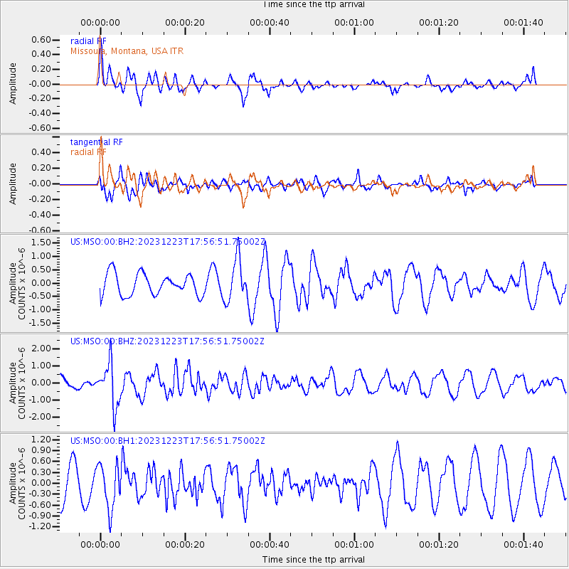
MSO Missoula, Montana, USA - Earthquake Result Viewer
*The percent match for this event was below the threshold and hence no stack was calculated.
| Earthquake location: |
Near East Coast Of Kamchatka |
| Earthquake latitude/longitude: |
52.0/159.0 |
| Earthquake time(UTC): |
2023/12/23 (357) 17:48:03 GMT |
| Earthquake Depth: |
29 km |
| Earthquake Magnitude: |
5.8 Mww |
| Earthquake Catalog/Contributor: |
NEIC PDE/us |
|
| Network: |
US United States National Seismic Network |
| Station: |
MSO Missoula, Montana, USA |
| Lat/Lon: |
46.83 N/113.94 W |
| Elevation: |
1264 m |
|
| Distance: |
53.7 deg |
| Az: |
58.351 deg |
| Baz: |
309.886 deg |
| Ray Param: |
$rayparam |
*The percent match for this event was below the threshold and hence was not used in the summary stack. |
|
| Radial Match: |
57.90207 % |
| Radial Bump: |
334 |
| Transverse Match: |
74.30986 % |
| Transverse Bump: |
364 |
| SOD ConfigId: |
33437571 |
| Insert Time: |
2024-01-06 18:22:35.596 +0000 |
| GWidth: |
2.5 |
| Max Bumps: |
400 |
| Tol: |
0.001 |
|
Signal To Noise
| Channel | StoN | STA | LTA |
| US:MSO:00:BHZ:20231223T17:56:51.75002Z | 4.4482045 | 1.2897475E-6 | 2.8994788E-7 |
| US:MSO:00:BH1:20231223T17:56:51.75002Z | 1.2985678 | 6.1741594E-7 | 4.7545916E-7 |
| US:MSO:00:BH2:20231223T17:56:51.75002Z | 2.017415 | 8.06592E-7 | 3.998146E-7 |
| Arrivals |
| Ps | |
| PpPs | |
| PsPs/PpSs | |


