You are here: Home > Network List > UU - University of Utah Regional Network Stations List
> Station FORU South Mineral Mountains, UT, USA > Earthquake Result Viewer
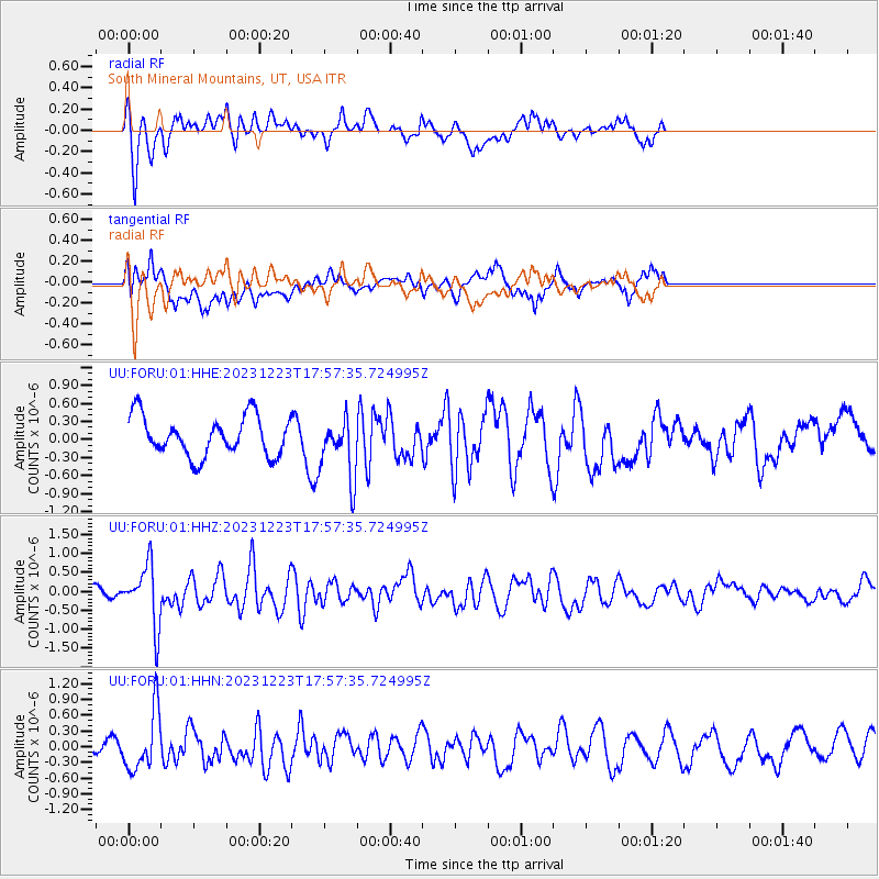
FORU South Mineral Mountains, UT, USA - Earthquake Result Viewer
*The percent match for this event was below the threshold and hence no stack was calculated.
| Earthquake location: |
Near East Coast Of Kamchatka |
| Earthquake latitude/longitude: |
52.0/159.0 |
| Earthquake time(UTC): |
2023/12/23 (357) 17:48:03 GMT |
| Earthquake Depth: |
29 km |
| Earthquake Magnitude: |
5.8 Mww |
| Earthquake Catalog/Contributor: |
NEIC PDE/us |
|
| Network: |
UU University of Utah Regional Network |
| Station: |
FORU South Mineral Mountains, UT, USA |
| Lat/Lon: |
38.46 N/112.86 W |
| Elevation: |
1840 m |
|
| Distance: |
59.9 deg |
| Az: |
65.128 deg |
| Baz: |
314.339 deg |
| Ray Param: |
$rayparam |
*The percent match for this event was below the threshold and hence was not used in the summary stack. |
|
| Radial Match: |
57.164124 % |
| Radial Bump: |
400 |
| Transverse Match: |
57.70453 % |
| Transverse Bump: |
400 |
| SOD ConfigId: |
33437571 |
| Insert Time: |
2024-01-06 18:23:09.950 +0000 |
| GWidth: |
2.5 |
| Max Bumps: |
400 |
| Tol: |
0.001 |
|
Signal To Noise
| Channel | StoN | STA | LTA |
| UU:FORU:01:HHZ:20231223T17:57:35.724995Z | 3.6843035 | 7.935248E-7 | 2.1537986E-7 |
| UU:FORU:01:HHN:20231223T17:57:35.724995Z | 4.6297693 | 5.626529E-7 | 1.2152934E-7 |
| UU:FORU:01:HHE:20231223T17:57:35.724995Z | 1.5581809 | 5.0727516E-7 | 3.2555602E-7 |
| Arrivals |
| Ps | |
| PpPs | |
| PsPs/PpSs | |


