You are here: Home > Network List > TA - USArray Transportable Network (new EarthScope stations) Stations List
> Station J27A Elkhorn Farm, Martin, SD, USA > Earthquake Result Viewer
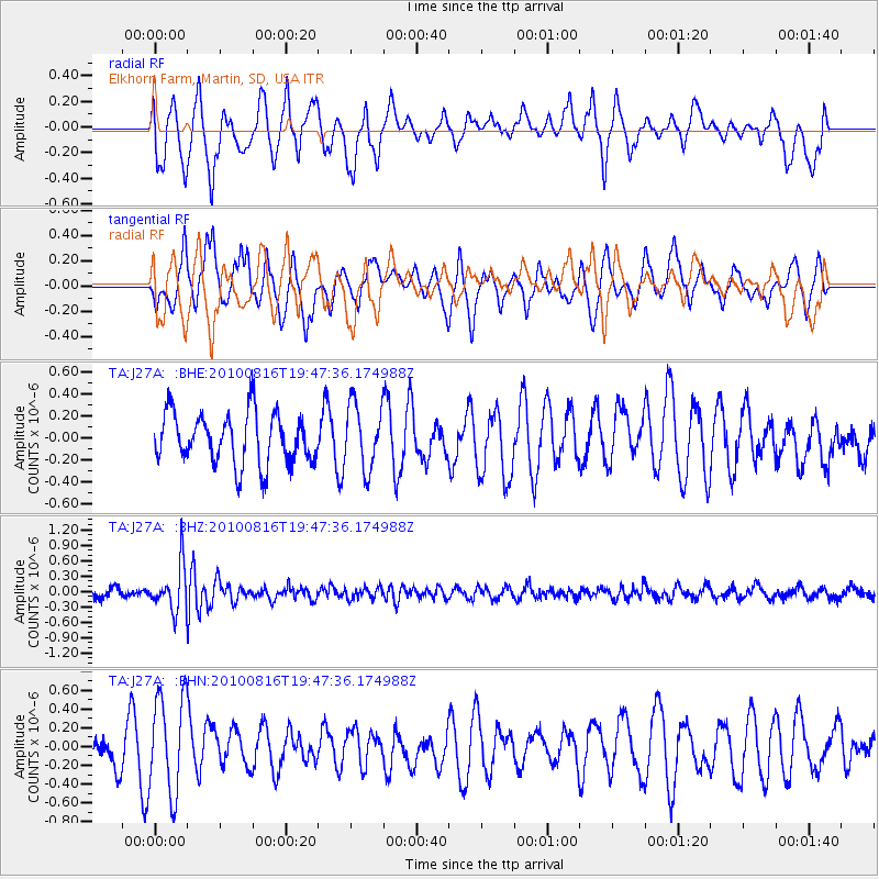
J27A Elkhorn Farm, Martin, SD, USA - Earthquake Result Viewer
*The percent match for this event was below the threshold and hence no stack was calculated.
| Earthquake location: |
Fiji Islands Region |
| Earthquake latitude/longitude: |
-20.8/-178.8 |
| Earthquake time(UTC): |
2010/08/16 (228) 19:35:49 GMT |
| Earthquake Depth: |
603 km |
| Earthquake Magnitude: |
5.7 MB, 6.2 MW, 6.1 MW |
| Earthquake Catalog/Contributor: |
WHDF/NEIC |
|
| Network: |
TA USArray Transportable Network (new EarthScope stations) |
| Station: |
J27A Elkhorn Farm, Martin, SD, USA |
| Lat/Lon: |
43.25 N/102.01 W |
| Elevation: |
1081 m |
|
| Distance: |
94.9 deg |
| Az: |
45.559 deg |
| Baz: |
246.105 deg |
| Ray Param: |
$rayparam |
*The percent match for this event was below the threshold and hence was not used in the summary stack. |
|
| Radial Match: |
49.58985 % |
| Radial Bump: |
400 |
| Transverse Match: |
61.199196 % |
| Transverse Bump: |
400 |
| SOD ConfigId: |
319893 |
| Insert Time: |
2011-01-06 00:35:36.166 +0000 |
| GWidth: |
2.5 |
| Max Bumps: |
400 |
| Tol: |
0.001 |
|
Signal To Noise
| Channel | StoN | STA | LTA |
| TA:J27A: :BHZ:20100816T19:47:36.174988Z | 4.6313434 | 4.4239414E-7 | 9.552177E-8 |
| TA:J27A: :BHN:20100816T19:47:36.174988Z | 4.6163907 | 5.2001593E-7 | 1.12645566E-7 |
| TA:J27A: :BHE:20100816T19:47:36.174988Z | 1.2724696 | 2.930726E-7 | 2.3031795E-7 |
| Arrivals |
| Ps | |
| PpPs | |
| PsPs/PpSs | |


