You are here: Home > Network List > TA - USArray Transportable Network (new EarthScope stations) Stations List
> Station V34A Guthrie, OK, USA > Earthquake Result Viewer
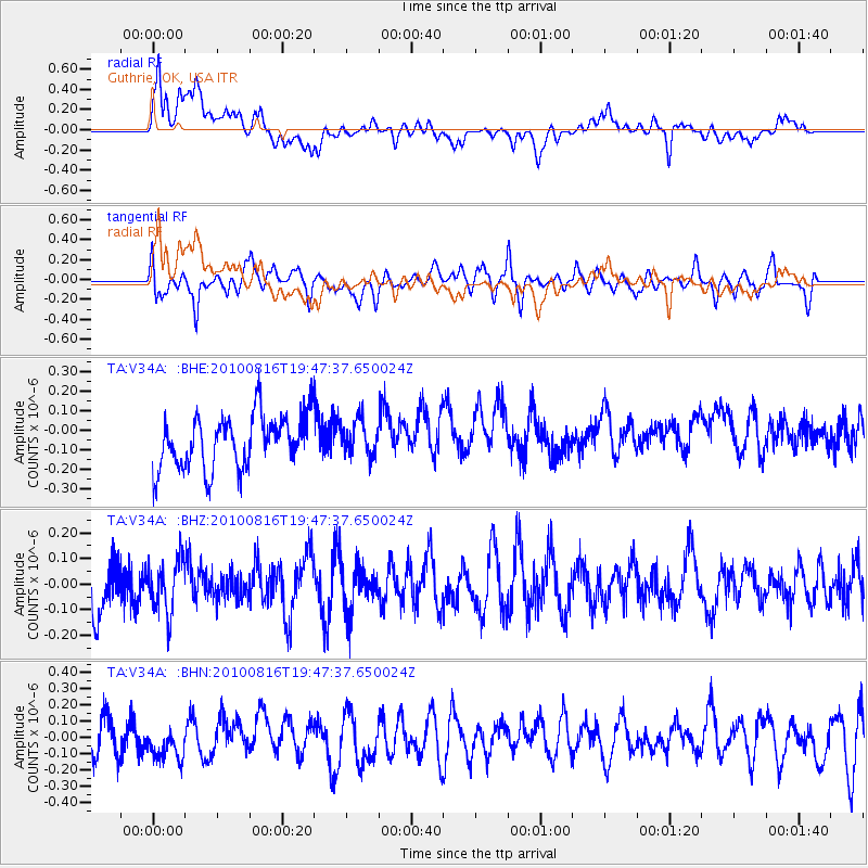
V34A Guthrie, OK, USA - Earthquake Result Viewer
*The percent match for this event was below the threshold and hence no stack was calculated.
| Earthquake location: |
Fiji Islands Region |
| Earthquake latitude/longitude: |
-20.8/-178.8 |
| Earthquake time(UTC): |
2010/08/16 (228) 19:35:49 GMT |
| Earthquake Depth: |
603 km |
| Earthquake Magnitude: |
5.7 MB, 6.2 MW, 6.1 MW |
| Earthquake Catalog/Contributor: |
WHDF/NEIC |
|
| Network: |
TA USArray Transportable Network (new EarthScope stations) |
| Station: |
V34A Guthrie, OK, USA |
| Lat/Lon: |
35.83 N/97.52 W |
| Elevation: |
329 m |
|
| Distance: |
95.2 deg |
| Az: |
53.763 deg |
| Baz: |
248.236 deg |
| Ray Param: |
$rayparam |
*The percent match for this event was below the threshold and hence was not used in the summary stack. |
|
| Radial Match: |
51.8637 % |
| Radial Bump: |
400 |
| Transverse Match: |
55.78107 % |
| Transverse Bump: |
400 |
| SOD ConfigId: |
319893 |
| Insert Time: |
2011-01-06 00:36:47.565 +0000 |
| GWidth: |
2.5 |
| Max Bumps: |
400 |
| Tol: |
0.001 |
|
Signal To Noise
| Channel | StoN | STA | LTA |
| TA:V34A: :BHZ:20100816T19:47:37.650024Z | 0.93615395 | 1.0338028E-7 | 1.10430854E-7 |
| TA:V34A: :BHN:20100816T19:47:37.650024Z | 0.70312583 | 8.775643E-8 | 1.24809E-7 |
| TA:V34A: :BHE:20100816T19:47:37.650024Z | 0.644847 | 8.661681E-8 | 1.3432148E-7 |
| Arrivals |
| Ps | |
| PpPs | |
| PsPs/PpSs | |


