You are here: Home > Network List > TA - USArray Transportable Network (new EarthScope stations) Stations List
> Station 334A Lometa, TX, USA > Earthquake Result Viewer
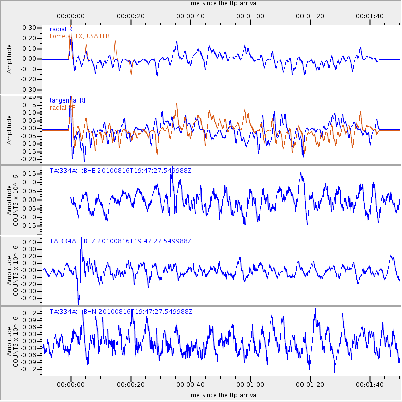
334A Lometa, TX, USA - Earthquake Result Viewer
*The percent match for this event was below the threshold and hence no stack was calculated.
| Earthquake location: |
Fiji Islands Region |
| Earthquake latitude/longitude: |
-20.8/-178.8 |
| Earthquake time(UTC): |
2010/08/16 (228) 19:35:49 GMT |
| Earthquake Depth: |
603 km |
| Earthquake Magnitude: |
5.7 MB, 6.2 MW, 6.1 MW |
| Earthquake Catalog/Contributor: |
WHDF/NEIC |
|
| Network: |
TA USArray Transportable Network (new EarthScope stations) |
| Station: |
334A Lometa, TX, USA |
| Lat/Lon: |
31.33 N/98.24 W |
| Elevation: |
389 m |
|
| Distance: |
93.0 deg |
| Az: |
57.706 deg |
| Baz: |
247.557 deg |
| Ray Param: |
$rayparam |
*The percent match for this event was below the threshold and hence was not used in the summary stack. |
|
| Radial Match: |
56.99003 % |
| Radial Bump: |
400 |
| Transverse Match: |
56.81927 % |
| Transverse Bump: |
400 |
| SOD ConfigId: |
319893 |
| Insert Time: |
2011-01-06 00:37:50.724 +0000 |
| GWidth: |
2.5 |
| Max Bumps: |
400 |
| Tol: |
0.001 |
|
Signal To Noise
| Channel | StoN | STA | LTA |
| TA:334A: :BHZ:20100816T19:47:27.549988Z | 3.3843212 | 1.9556855E-7 | 5.778664E-8 |
| TA:334A: :BHN:20100816T19:47:27.549988Z | 1.6897283 | 5.625857E-8 | 3.3294448E-8 |
| TA:334A: :BHE:20100816T19:47:27.549988Z | 1.7305225 | 7.3600354E-8 | 4.253071E-8 |
| Arrivals |
| Ps | |
| PpPs | |
| PsPs/PpSs | |


