You are here: Home > Network List > US - United States National Seismic Network Stations List
> Station MSO Missoula, Montana, USA > Earthquake Result Viewer
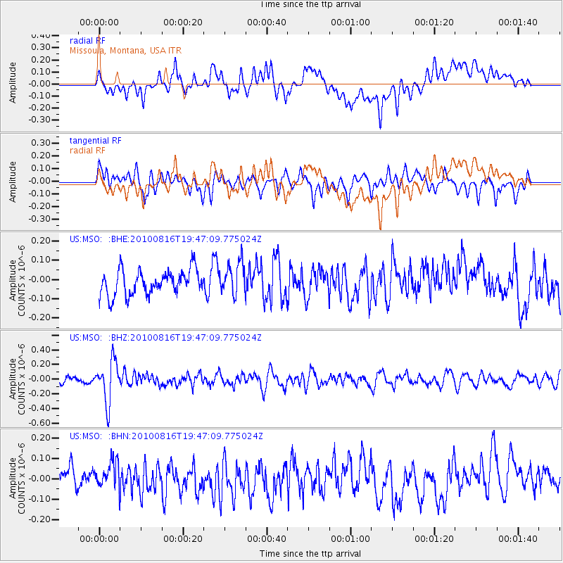
MSO Missoula, Montana, USA - Earthquake Result Viewer
*The percent match for this event was below the threshold and hence no stack was calculated.
| Earthquake location: |
Fiji Islands Region |
| Earthquake latitude/longitude: |
-20.8/-178.8 |
| Earthquake time(UTC): |
2010/08/16 (228) 19:35:49 GMT |
| Earthquake Depth: |
603 km |
| Earthquake Magnitude: |
5.7 MB, 6.2 MW, 6.1 MW |
| Earthquake Catalog/Contributor: |
WHDF/NEIC |
|
| Network: |
US United States National Seismic Network |
| Station: |
MSO Missoula, Montana, USA |
| Lat/Lon: |
46.83 N/113.94 W |
| Elevation: |
1264 m |
|
| Distance: |
89.1 deg |
| Az: |
38.447 deg |
| Baz: |
237.917 deg |
| Ray Param: |
$rayparam |
*The percent match for this event was below the threshold and hence was not used in the summary stack. |
|
| Radial Match: |
43.216225 % |
| Radial Bump: |
400 |
| Transverse Match: |
67.80724 % |
| Transverse Bump: |
400 |
| SOD ConfigId: |
319893 |
| Insert Time: |
2011-01-06 00:42:22.254 +0000 |
| GWidth: |
2.5 |
| Max Bumps: |
400 |
| Tol: |
0.001 |
|
Signal To Noise
| Channel | StoN | STA | LTA |
| US:MSO: :BHZ:20100816T19:47:09.775024Z | 4.8000655 | 2.909019E-7 | 6.060374E-8 |
| US:MSO: :BHN:20100816T19:47:09.775024Z | 1.582819 | 7.1829824E-8 | 4.5380943E-8 |
| US:MSO: :BHE:20100816T19:47:09.775024Z | 1.3450692 | 8.577163E-8 | 6.376745E-8 |
| Arrivals |
| Ps | |
| PpPs | |
| PsPs/PpSs | |


