You are here: Home > Network List > US - United States National Seismic Network Stations List
> Station DGMT Dagmar, Montana, USA > Earthquake Result Viewer
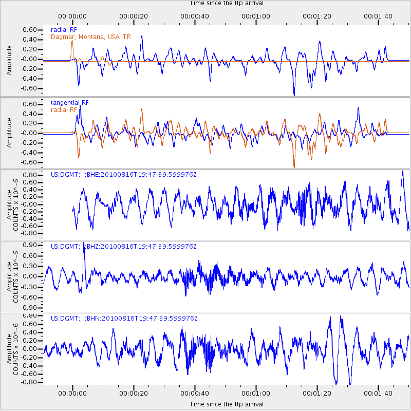
DGMT Dagmar, Montana, USA - Earthquake Result Viewer
*The percent match for this event was below the threshold and hence no stack was calculated.
| Earthquake location: |
Fiji Islands Region |
| Earthquake latitude/longitude: |
-20.8/-178.8 |
| Earthquake time(UTC): |
2010/08/16 (228) 19:35:49 GMT |
| Earthquake Depth: |
603 km |
| Earthquake Magnitude: |
5.7 MB, 6.2 MW, 6.1 MW |
| Earthquake Catalog/Contributor: |
WHDF/NEIC |
|
| Network: |
US United States National Seismic Network |
| Station: |
DGMT Dagmar, Montana, USA |
| Lat/Lon: |
48.47 N/104.20 W |
| Elevation: |
0.0 m |
|
| Distance: |
95.7 deg |
| Az: |
40.153 deg |
| Baz: |
245.035 deg |
| Ray Param: |
$rayparam |
*The percent match for this event was below the threshold and hence was not used in the summary stack. |
|
| Radial Match: |
70.87803 % |
| Radial Bump: |
400 |
| Transverse Match: |
59.134792 % |
| Transverse Bump: |
400 |
| SOD ConfigId: |
319893 |
| Insert Time: |
2011-01-06 00:42:35.219 +0000 |
| GWidth: |
2.5 |
| Max Bumps: |
400 |
| Tol: |
0.001 |
|
Signal To Noise
| Channel | StoN | STA | LTA |
| US:DGMT: :BHZ:20100816T19:47:39.599976Z | 2.151712 | 3.2898592E-7 | 1.5289496E-7 |
| US:DGMT: :BHN:20100816T19:47:39.599976Z | 0.37289155 | 1.08731584E-7 | 2.9159037E-7 |
| US:DGMT: :BHE:20100816T19:47:39.599976Z | 1.239849 | 3.2547916E-7 | 2.625152E-7 |
| Arrivals |
| Ps | |
| PpPs | |
| PsPs/PpSs | |


