You are here: Home > Network List > US - United States National Seismic Network Stations List
> Station MNTX Cornudas Mountains, Texas, USA > Earthquake Result Viewer
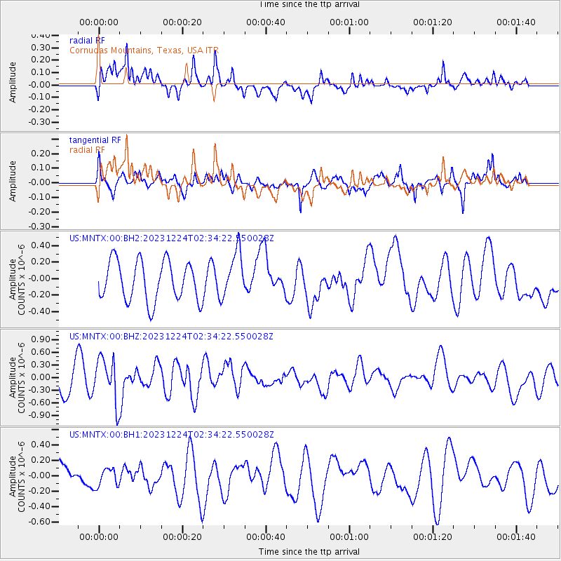
MNTX Cornudas Mountains, Texas, USA - Earthquake Result Viewer
*The percent match for this event was below the threshold and hence no stack was calculated.
| Earthquake location: |
Tonga Islands Region |
| Earthquake latitude/longitude: |
-22.7/-175.7 |
| Earthquake time(UTC): |
2023/12/24 (358) 02:22:17 GMT |
| Earthquake Depth: |
49 km |
| Earthquake Magnitude: |
5.3 Mww |
| Earthquake Catalog/Contributor: |
NEIC PDE/us |
|
| Network: |
US United States National Seismic Network |
| Station: |
MNTX Cornudas Mountains, Texas, USA |
| Lat/Lon: |
31.70 N/105.38 W |
| Elevation: |
405 m |
|
| Distance: |
86.3 deg |
| Az: |
53.52 deg |
| Baz: |
240.552 deg |
| Ray Param: |
$rayparam |
*The percent match for this event was below the threshold and hence was not used in the summary stack. |
|
| Radial Match: |
50.414734 % |
| Radial Bump: |
400 |
| Transverse Match: |
59.302383 % |
| Transverse Bump: |
400 |
| SOD ConfigId: |
33437571 |
| Insert Time: |
2024-01-07 02:54:00.024 +0000 |
| GWidth: |
2.5 |
| Max Bumps: |
400 |
| Tol: |
0.001 |
|
Signal To Noise
| Channel | StoN | STA | LTA |
| US:MNTX:00:BHZ:20231224T02:34:22.550028Z | 1.5232657 | 5.3456E-7 | 3.5093024E-7 |
| US:MNTX:00:BH1:20231224T02:34:22.550028Z | 0.6126191 | 1.1393436E-7 | 1.8597913E-7 |
| US:MNTX:00:BH2:20231224T02:34:22.550028Z | 1.175106 | 2.8418776E-7 | 2.418401E-7 |
| Arrivals |
| Ps | |
| PpPs | |
| PsPs/PpSs | |


