You are here: Home > Network List > US - United States National Seismic Network Stations List
> Station WMOK Wichita Mountains, Oklahoma, USA > Earthquake Result Viewer
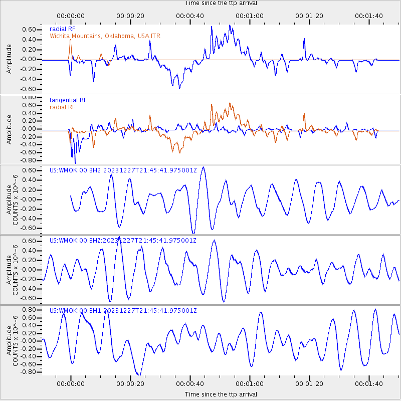
WMOK Wichita Mountains, Oklahoma, USA - Earthquake Result Viewer
*The percent match for this event was below the threshold and hence no stack was calculated.
| Earthquake location: |
Southern East Pacific Rise |
| Earthquake latitude/longitude: |
-53.1/-118.3 |
| Earthquake time(UTC): |
2023/12/27 (361) 21:33:18 GMT |
| Earthquake Depth: |
10 km |
| Earthquake Magnitude: |
5.7 mww |
| Earthquake Catalog/Contributor: |
NEIC PDE/us |
|
| Network: |
US United States National Seismic Network |
| Station: |
WMOK Wichita Mountains, Oklahoma, USA |
| Lat/Lon: |
34.74 N/98.78 W |
| Elevation: |
486 m |
|
| Distance: |
89.1 deg |
| Az: |
15.976 deg |
| Baz: |
191.625 deg |
| Ray Param: |
$rayparam |
*The percent match for this event was below the threshold and hence was not used in the summary stack. |
|
| Radial Match: |
52.180794 % |
| Radial Bump: |
400 |
| Transverse Match: |
68.69184 % |
| Transverse Bump: |
400 |
| SOD ConfigId: |
33437571 |
| Insert Time: |
2024-01-10 21:49:48.739 +0000 |
| GWidth: |
2.5 |
| Max Bumps: |
400 |
| Tol: |
0.001 |
|
Signal To Noise
| Channel | StoN | STA | LTA |
| US:WMOK:00:BHZ:20231227T21:45:41.975001Z | 0.6746412 | 1.2709093E-7 | 1.88383E-7 |
| US:WMOK:00:BH1:20231227T21:45:41.975001Z | 1.9450766 | 4.9272256E-7 | 2.5331784E-7 |
| US:WMOK:00:BH2:20231227T21:45:41.975001Z | 0.6052323 | 1.5601013E-7 | 2.5776902E-7 |
| Arrivals |
| Ps | |
| PpPs | |
| PsPs/PpSs | |


