You are here: Home > Network List > TA - USArray Transportable Network (new EarthScope stations) Stations List
> Station M04C Macdoel, CA, USA > Earthquake Result Viewer
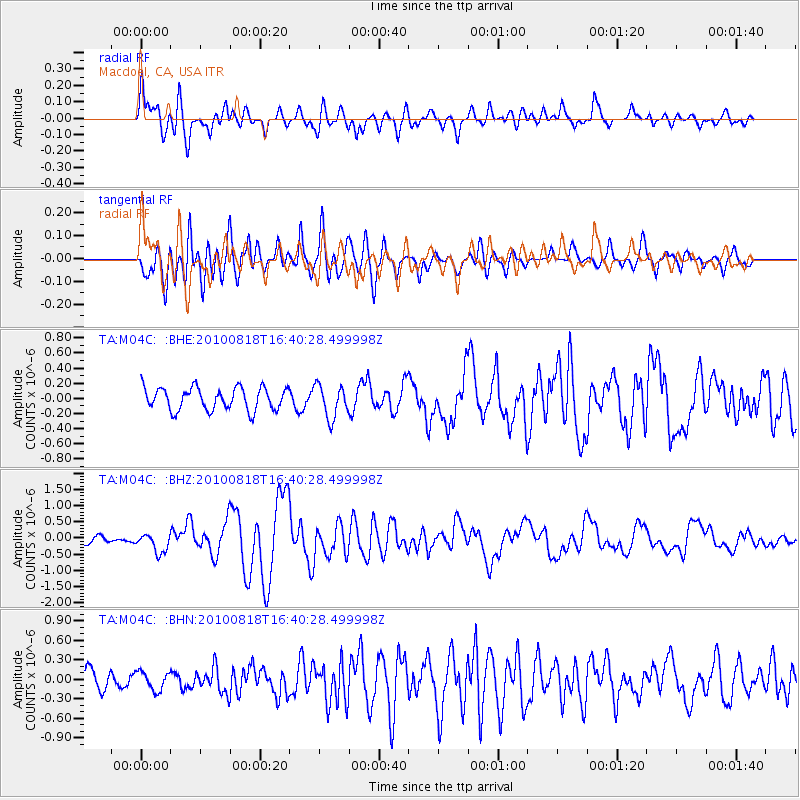
M04C Macdoel, CA, USA - Earthquake Result Viewer
*The percent match for this event was below the threshold and hence no stack was calculated.
| Earthquake location: |
South Of Mariana Islands |
| Earthquake latitude/longitude: |
12.2/141.5 |
| Earthquake time(UTC): |
2010/08/18 (230) 16:28:15 GMT |
| Earthquake Depth: |
10 km |
| Earthquake Magnitude: |
5.8 MB, 5.9 MS, 6.3 MW, 6.2 MW |
| Earthquake Catalog/Contributor: |
WHDF/NEIC |
|
| Network: |
TA USArray Transportable Network (new EarthScope stations) |
| Station: |
M04C Macdoel, CA, USA |
| Lat/Lon: |
41.78 N/121.84 W |
| Elevation: |
1391 m |
|
| Distance: |
86.8 deg |
| Az: |
48.073 deg |
| Baz: |
283.47 deg |
| Ray Param: |
$rayparam |
*The percent match for this event was below the threshold and hence was not used in the summary stack. |
|
| Radial Match: |
78.94398 % |
| Radial Bump: |
400 |
| Transverse Match: |
79.792206 % |
| Transverse Bump: |
400 |
| SOD ConfigId: |
319893 |
| Insert Time: |
2011-01-06 00:56:06.142 +0000 |
| GWidth: |
2.5 |
| Max Bumps: |
400 |
| Tol: |
0.001 |
|
Signal To Noise
| Channel | StoN | STA | LTA |
| TA:M04C: :BHZ:20100818T16:40:28.499998Z | 2.2276778 | 2.8873026E-7 | 1.2961043E-7 |
| TA:M04C: :BHN:20100818T16:40:28.499998Z | 1.0705934 | 1.4191423E-7 | 1.3255662E-7 |
| TA:M04C: :BHE:20100818T16:40:28.499998Z | 1.4724811 | 2.1726497E-7 | 1.4755027E-7 |
| Arrivals |
| Ps | |
| PpPs | |
| PsPs/PpSs | |


