You are here: Home > Network List > GS - US Geological Survey Networks Stations List
> Station OK051 E0350 and S34600 roads, Ralston OK > Earthquake Result Viewer
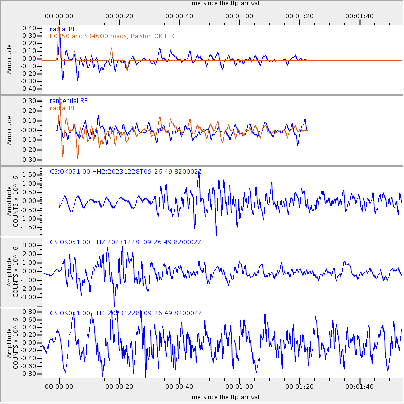
OK051 E0350 and S34600 roads, Ralston OK - Earthquake Result Viewer
*The percent match for this event was below the threshold and hence no stack was calculated.
| Earthquake location: |
Kuril Islands |
| Earthquake latitude/longitude: |
44.6/149.0 |
| Earthquake time(UTC): |
2023/12/28 (362) 09:15:15 GMT |
| Earthquake Depth: |
24 km |
| Earthquake Magnitude: |
6.5 Mww |
| Earthquake Catalog/Contributor: |
NEIC PDE/us |
|
| Network: |
GS US Geological Survey Networks |
| Station: |
OK051 E0350 and S34600 roads, Ralston OK |
| Lat/Lon: |
36.50 N/96.84 W |
| Elevation: |
263 m |
|
| Distance: |
79.7 deg |
| Az: |
48.336 deg |
| Baz: |
318.501 deg |
| Ray Param: |
$rayparam |
*The percent match for this event was below the threshold and hence was not used in the summary stack. |
|
| Radial Match: |
72.21416 % |
| Radial Bump: |
400 |
| Transverse Match: |
47.297157 % |
| Transverse Bump: |
400 |
| SOD ConfigId: |
33437571 |
| Insert Time: |
2024-01-11 09:34:31.127 +0000 |
| GWidth: |
2.5 |
| Max Bumps: |
400 |
| Tol: |
0.001 |
|
Signal To Noise
| Channel | StoN | STA | LTA |
| GS:OK051:00:HHZ:20231228T09:26:49.820002Z | 4.2386627 | 8.82424E-7 | 2.0818453E-7 |
| GS:OK051:00:HH1:20231228T09:26:49.820002Z | 1.9701229 | 4.4002988E-7 | 2.2335148E-7 |
| GS:OK051:00:HH2:20231228T09:26:49.820002Z | 1.8527992 | 3.862187E-7 | 2.0845147E-7 |
| Arrivals |
| Ps | |
| PpPs | |
| PsPs/PpSs | |


