You are here: Home > Network List > CI - Caltech Regional Seismic Network Stations List
> Station TUQ Turquiose Mountain, Baker, CA, USA > Earthquake Result Viewer
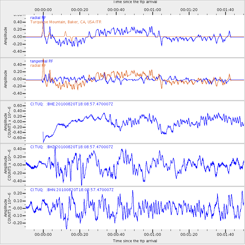
TUQ Turquiose Mountain, Baker, CA, USA - Earthquake Result Viewer
*The percent match for this event was below the threshold and hence no stack was calculated.
| Earthquake location: |
Solomon Islands |
| Earthquake latitude/longitude: |
-6.6/154.2 |
| Earthquake time(UTC): |
2010/08/20 (232) 17:56:14 GMT |
| Earthquake Depth: |
19 km |
| Earthquake Magnitude: |
5.5 MB, 6.1 MS, 6.1 MW, 6.0 MW |
| Earthquake Catalog/Contributor: |
WHDF/NEIC |
|
| Network: |
CI Caltech Regional Seismic Network |
| Station: |
TUQ Turquiose Mountain, Baker, CA, USA |
| Lat/Lon: |
35.44 N/115.92 W |
| Elevation: |
1350 m |
|
| Distance: |
93.6 deg |
| Az: |
54.908 deg |
| Baz: |
264.566 deg |
| Ray Param: |
$rayparam |
*The percent match for this event was below the threshold and hence was not used in the summary stack. |
|
| Radial Match: |
33.909325 % |
| Radial Bump: |
400 |
| Transverse Match: |
47.050236 % |
| Transverse Bump: |
400 |
| SOD ConfigId: |
319893 |
| Insert Time: |
2011-01-06 01:03:24.973 +0000 |
| GWidth: |
2.5 |
| Max Bumps: |
400 |
| Tol: |
0.001 |
|
Signal To Noise
| Channel | StoN | STA | LTA |
| CI:TUQ: :BHZ:20100820T18:08:57.470007Z | 1.5497987 | 8.4911164E-8 | 5.4788508E-8 |
| CI:TUQ: :BHN:20100820T18:08:57.470007Z | 1.0125713 | 7.386975E-8 | 7.2952645E-8 |
| CI:TUQ: :BHE:20100820T18:08:57.470007Z | 1.3421289 | 3.3936536E-7 | 2.52856E-7 |
| Arrivals |
| Ps | |
| PpPs | |
| PsPs/PpSs | |


