You are here: Home > Network List > US - United States National Seismic Network Stations List
> Station CBKS Cedar Bluff, Kansas, USA > Earthquake Result Viewer
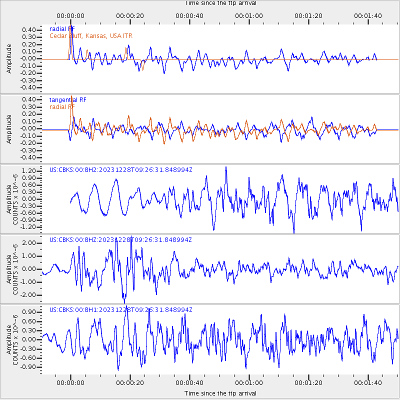
CBKS Cedar Bluff, Kansas, USA - Earthquake Result Viewer
*The percent match for this event was below the threshold and hence no stack was calculated.
| Earthquake location: |
Kuril Islands |
| Earthquake latitude/longitude: |
44.6/149.0 |
| Earthquake time(UTC): |
2023/12/28 (362) 09:15:15 GMT |
| Earthquake Depth: |
24 km |
| Earthquake Magnitude: |
6.5 Mww |
| Earthquake Catalog/Contributor: |
NEIC PDE/us |
|
| Network: |
US United States National Seismic Network |
| Station: |
CBKS Cedar Bluff, Kansas, USA |
| Lat/Lon: |
38.81 N/99.74 W |
| Elevation: |
677 m |
|
| Distance: |
76.5 deg |
| Az: |
48.488 deg |
| Baz: |
316.766 deg |
| Ray Param: |
$rayparam |
*The percent match for this event was below the threshold and hence was not used in the summary stack. |
|
| Radial Match: |
76.03023 % |
| Radial Bump: |
400 |
| Transverse Match: |
61.869827 % |
| Transverse Bump: |
400 |
| SOD ConfigId: |
33437571 |
| Insert Time: |
2024-01-11 09:49:53.039 +0000 |
| GWidth: |
2.5 |
| Max Bumps: |
400 |
| Tol: |
0.001 |
|
Signal To Noise
| Channel | StoN | STA | LTA |
| US:CBKS:00:BHZ:20231228T09:26:31.848994Z | 3.7421124 | 8.8511126E-7 | 2.3652717E-7 |
| US:CBKS:00:BH1:20231228T09:26:31.848994Z | 1.5735862 | 4.0356875E-7 | 2.5646435E-7 |
| US:CBKS:00:BH2:20231228T09:26:31.848994Z | 0.62288225 | 2.6484489E-7 | 4.2519252E-7 |
| Arrivals |
| Ps | |
| PpPs | |
| PsPs/PpSs | |


