
MDJ Mudanjiang, Heilongjiang Province, China - Earthquake Result Viewer
| ||||||||||||||||||
| ||||||||||||||||||
| ||||||||||||||||||
|
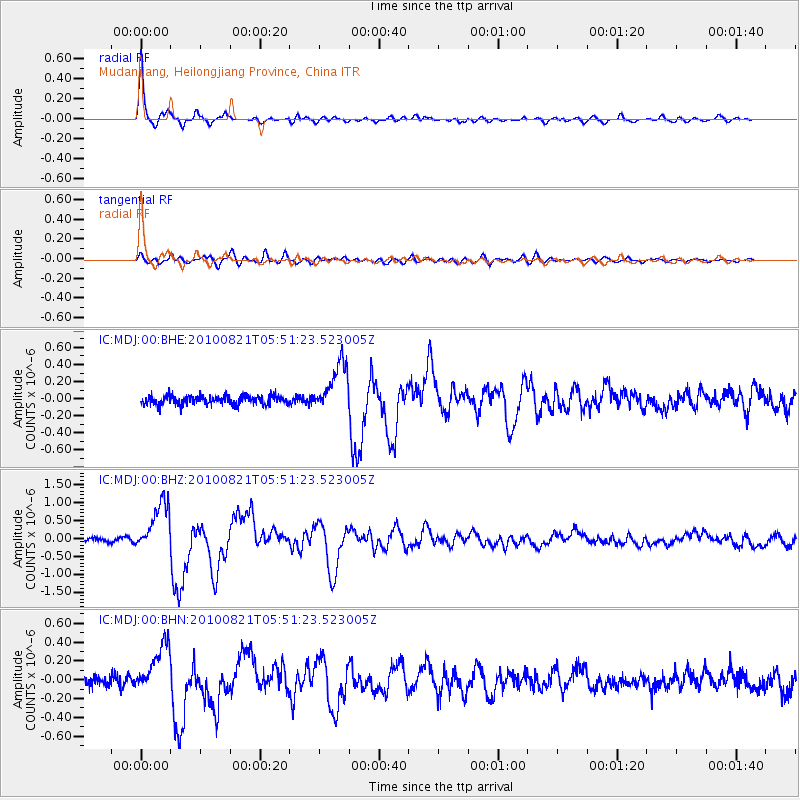
Signal To Noise
| Channel | StoN | STA | LTA |
| IC:MDJ:00:BHZ:20100821T05:51:23.523005Z | 14.82938 | 6.981034E-7 | 4.7075698E-8 |
| IC:MDJ:00:BHN:20100821T05:51:23.523005Z | 4.662653 | 2.6447253E-7 | 5.6721472E-8 |
| IC:MDJ:00:BHE:20100821T05:51:23.523005Z | 5.538253 | 2.8780036E-7 | 5.1965916E-8 |
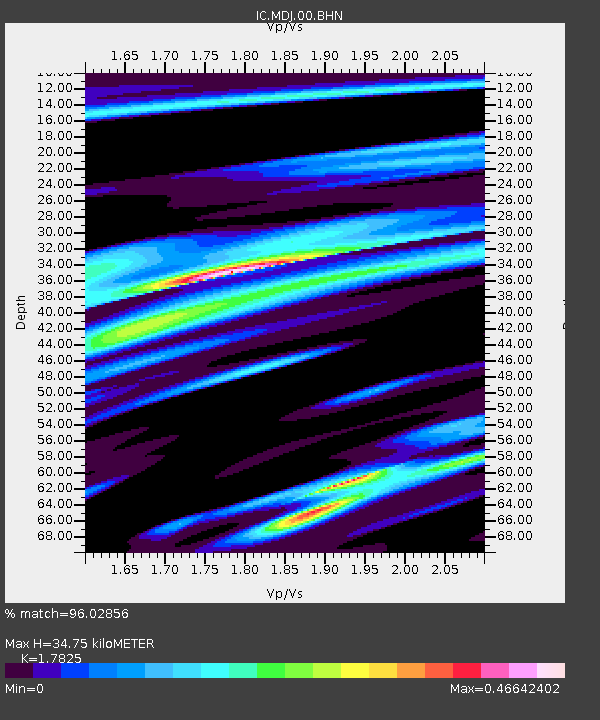
| Arrivals | |
| Ps | 4.5 SECOND |
| PpPs | 14 SECOND |
| PsPs/PpSs | 19 SECOND |

