You are here: Home > Network List > IU - Global Seismograph Network (GSN - IRIS/USGS) Stations List
> Station CTAO Charters Towers, Australia > Earthquake Result Viewer
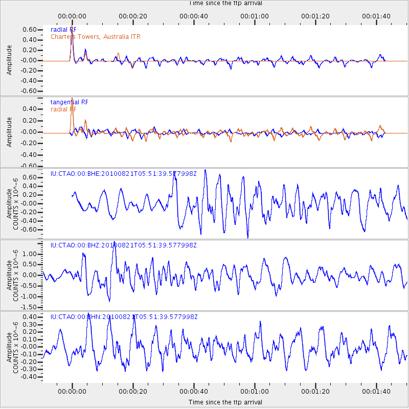
CTAO Charters Towers, Australia - Earthquake Result Viewer
*The percent match for this event was below the threshold and hence no stack was calculated.
| Earthquake location: |
Northern Sumatra, Indonesia |
| Earthquake latitude/longitude: |
2.2/96.7 |
| Earthquake time(UTC): |
2010/08/21 (233) 05:42:52 GMT |
| Earthquake Depth: |
24 km |
| Earthquake Magnitude: |
5.6 MB, 5.8 MS, 6.0 MW, 5.9 MW |
| Earthquake Catalog/Contributor: |
WHDF/NEIC |
|
| Network: |
IU Global Seismograph Network (GSN - IRIS/USGS) |
| Station: |
CTAO Charters Towers, Australia |
| Lat/Lon: |
20.09 S/146.25 E |
| Elevation: |
357 m |
|
| Distance: |
53.4 deg |
| Az: |
117.019 deg |
| Baz: |
288.717 deg |
| Ray Param: |
$rayparam |
*The percent match for this event was below the threshold and hence was not used in the summary stack. |
|
| Radial Match: |
73.03413 % |
| Radial Bump: |
278 |
| Transverse Match: |
62.21533 % |
| Transverse Bump: |
400 |
| SOD ConfigId: |
319893 |
| Insert Time: |
2011-01-06 01:09:57.402 +0000 |
| GWidth: |
2.5 |
| Max Bumps: |
400 |
| Tol: |
0.001 |
|
Signal To Noise
| Channel | StoN | STA | LTA |
| IU:CTAO:00:BHZ:20100821T05:51:39.577998Z | 1.9028043 | 4.6013685E-7 | 2.4182037E-7 |
| IU:CTAO:00:BHN:20100821T05:51:39.577998Z | 1.068772 | 1.0727376E-7 | 1.00371054E-7 |
| IU:CTAO:00:BHE:20100821T05:51:39.577998Z | 1.8662881 | 3.1918594E-7 | 1.7102715E-7 |
| Arrivals |
| Ps | |
| PpPs | |
| PsPs/PpSs | |


