You are here: Home > Network List > GS - US Geological Survey Networks Stations List
> Station KAN13 Rinehart Farm > Earthquake Result Viewer
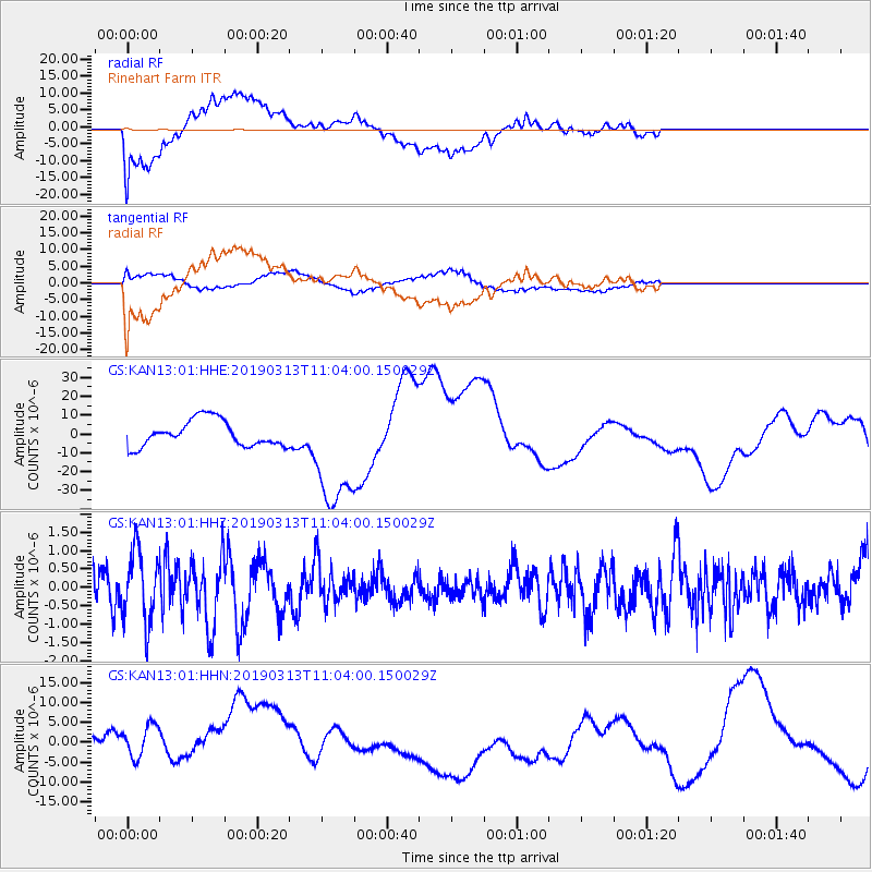
KAN13 Rinehart Farm - Earthquake Result Viewer
*The percent match for this event was below the threshold and hence no stack was calculated.
| Earthquake location: |
Hawaii |
| Earthquake latitude/longitude: |
19.3/-155.2 |
| Earthquake time(UTC): |
2019/03/13 (072) 10:55:13 GMT |
| Earthquake Depth: |
7.0 km |
| Earthquake Magnitude: |
5.5 Ml |
| Earthquake Catalog/Contributor: |
NEIC PDE/hv |
|
| Network: |
GS US Geological Survey Networks |
| Station: |
KAN13 Rinehart Farm |
| Lat/Lon: |
37.01 N/97.48 W |
| Elevation: |
340 m |
|
| Distance: |
53.1 deg |
| Az: |
57.844 deg |
| Baz: |
267.206 deg |
| Ray Param: |
$rayparam |
*The percent match for this event was below the threshold and hence was not used in the summary stack. |
|
| Radial Match: |
58.09369 % |
| Radial Bump: |
400 |
| Transverse Match: |
50.999012 % |
| Transverse Bump: |
400 |
| SOD ConfigId: |
3338192 |
| Insert Time: |
2019-03-27 11:17:19.066 +0000 |
| GWidth: |
2.5 |
| Max Bumps: |
400 |
| Tol: |
0.001 |
|
Signal To Noise
| Channel | StoN | STA | LTA |
| GS:KAN13:01:HHZ:20190313T11:04:00.150029Z | 2.2900193 | 9.718858E-7 | 4.244007E-7 |
| GS:KAN13:01:HHN:20190313T11:04:00.150029Z | 1.1271079 | 6.9027233E-6 | 6.124279E-6 |
| GS:KAN13:01:HHE:20190313T11:04:00.150029Z | 4.378371 | 3.0340214E-5 | 6.9295675E-6 |
| Arrivals |
| Ps | |
| PpPs | |
| PsPs/PpSs | |


