You are here: Home > Network List > CI - Caltech Regional Seismic Network Stations List
> Station TIN Tinemaha, Big Pine, CA, USA > Earthquake Result Viewer
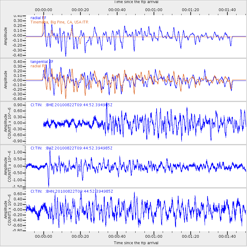
TIN Tinemaha, Big Pine, CA, USA - Earthquake Result Viewer
*The percent match for this event was below the threshold and hence no stack was calculated.
| Earthquake location: |
Mariana Islands Region |
| Earthquake latitude/longitude: |
19.4/147.4 |
| Earthquake time(UTC): |
2010/08/22 (234) 09:33:06 GMT |
| Earthquake Depth: |
23 km |
| Earthquake Magnitude: |
5.9 MB, 5.3 MS, 5.5 MW |
| Earthquake Catalog/Contributor: |
WHDF/NEIC |
|
| Network: |
CI Caltech Regional Seismic Network |
| Station: |
TIN Tinemaha, Big Pine, CA, USA |
| Lat/Lon: |
37.05 N/118.23 W |
| Elevation: |
1197 m |
|
| Distance: |
81.9 deg |
| Az: |
53.675 deg |
| Baz: |
288.127 deg |
| Ray Param: |
$rayparam |
*The percent match for this event was below the threshold and hence was not used in the summary stack. |
|
| Radial Match: |
70.680954 % |
| Radial Bump: |
400 |
| Transverse Match: |
57.708847 % |
| Transverse Bump: |
400 |
| SOD ConfigId: |
319893 |
| Insert Time: |
2011-01-06 01:16:58.793 +0000 |
| GWidth: |
2.5 |
| Max Bumps: |
400 |
| Tol: |
0.001 |
|
Signal To Noise
| Channel | StoN | STA | LTA |
| CI:TIN: :BHZ:20100822T09:44:52.394985Z | 3.6660113 | 4.911398E-7 | 1.3397117E-7 |
| CI:TIN: :BHN:20100822T09:44:52.394985Z | 1.0138959 | 1.6869366E-7 | 1.6638165E-7 |
| CI:TIN: :BHE:20100822T09:44:52.394985Z | 2.94851 | 3.1093037E-7 | 1.0545339E-7 |
| Arrivals |
| Ps | |
| PpPs | |
| PsPs/PpSs | |


