You are here: Home > Network List > CI - Caltech Regional Seismic Network Stations List
> Station MPM Manuel Prospect Mine, California, USA > Earthquake Result Viewer
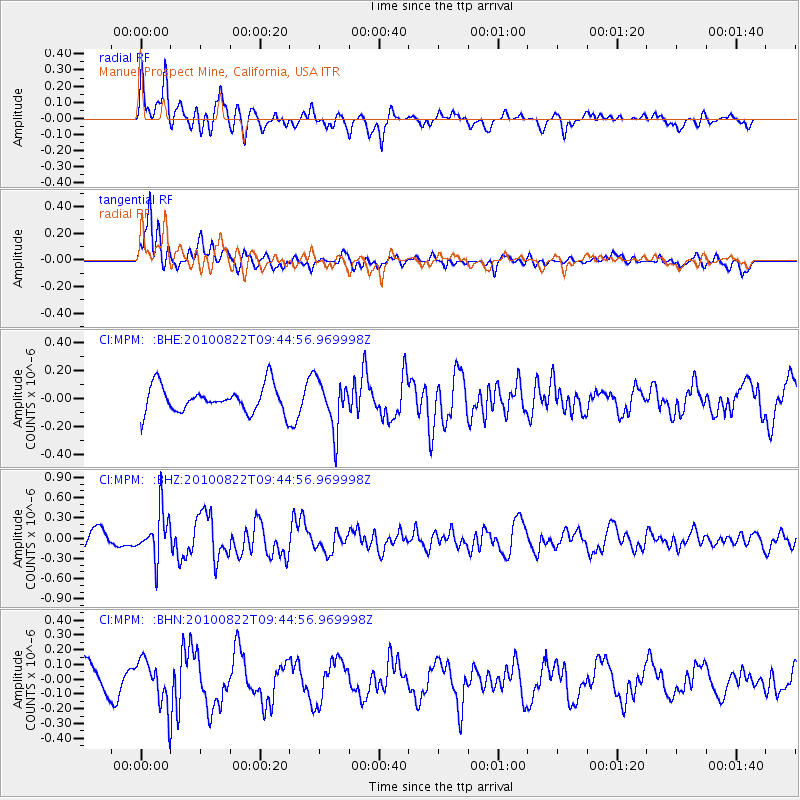
MPM Manuel Prospect Mine, California, USA - Earthquake Result Viewer
*The percent match for this event was below the threshold and hence no stack was calculated.
| Earthquake location: |
Mariana Islands Region |
| Earthquake latitude/longitude: |
19.4/147.4 |
| Earthquake time(UTC): |
2010/08/22 (234) 09:33:06 GMT |
| Earthquake Depth: |
23 km |
| Earthquake Magnitude: |
5.9 MB, 5.3 MS, 5.5 MW |
| Earthquake Catalog/Contributor: |
WHDF/NEIC |
|
| Network: |
CI Caltech Regional Seismic Network |
| Station: |
MPM Manuel Prospect Mine, California, USA |
| Lat/Lon: |
36.06 N/117.49 W |
| Elevation: |
185 m |
|
| Distance: |
82.8 deg |
| Az: |
54.437 deg |
| Baz: |
288.668 deg |
| Ray Param: |
$rayparam |
*The percent match for this event was below the threshold and hence was not used in the summary stack. |
|
| Radial Match: |
63.74006 % |
| Radial Bump: |
400 |
| Transverse Match: |
82.516525 % |
| Transverse Bump: |
400 |
| SOD ConfigId: |
319893 |
| Insert Time: |
2011-01-06 01:18:19.943 +0000 |
| GWidth: |
2.5 |
| Max Bumps: |
400 |
| Tol: |
0.001 |
|
Signal To Noise
| Channel | StoN | STA | LTA |
| CI:MPM: :BHZ:20100822T09:44:56.969998Z | 2.7812817 | 3.426588E-7 | 1.2320176E-7 |
| CI:MPM: :BHN:20100822T09:44:56.969998Z | 1.4070238 | 1.5653669E-7 | 1.1125376E-7 |
| CI:MPM: :BHE:20100822T09:44:56.969998Z | 1.8405242 | 1.7526358E-7 | 9.522481E-8 |
| Arrivals |
| Ps | |
| PpPs | |
| PsPs/PpSs | |


