You are here: Home > Network List > TA - USArray Transportable Network (new EarthScope stations) Stations List
> Station R31A Burdett, KS, USA > Earthquake Result Viewer
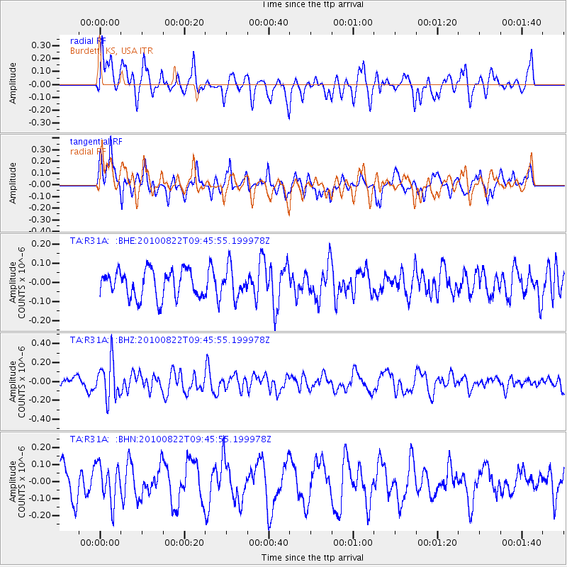
R31A Burdett, KS, USA - Earthquake Result Viewer
*The percent match for this event was below the threshold and hence no stack was calculated.
| Earthquake location: |
Mariana Islands Region |
| Earthquake latitude/longitude: |
19.4/147.4 |
| Earthquake time(UTC): |
2010/08/22 (234) 09:33:06 GMT |
| Earthquake Depth: |
23 km |
| Earthquake Magnitude: |
5.9 MB, 5.3 MS, 5.5 MW |
| Earthquake Catalog/Contributor: |
WHDF/NEIC |
|
| Network: |
TA USArray Transportable Network (new EarthScope stations) |
| Station: |
R31A Burdett, KS, USA |
| Lat/Lon: |
38.29 N/99.53 W |
| Elevation: |
667 m |
|
| Distance: |
95.0 deg |
| Az: |
46.603 deg |
| Baz: |
299.381 deg |
| Ray Param: |
$rayparam |
*The percent match for this event was below the threshold and hence was not used in the summary stack. |
|
| Radial Match: |
45.842247 % |
| Radial Bump: |
400 |
| Transverse Match: |
53.73385 % |
| Transverse Bump: |
357 |
| SOD ConfigId: |
319893 |
| Insert Time: |
2011-01-06 01:34:17.355 +0000 |
| GWidth: |
2.5 |
| Max Bumps: |
400 |
| Tol: |
0.001 |
|
Signal To Noise
| Channel | StoN | STA | LTA |
| TA:R31A: :BHZ:20100822T09:45:55.199978Z | 3.9637244 | 2.0306173E-7 | 5.1230035E-8 |
| TA:R31A: :BHN:20100822T09:45:55.199978Z | 1.2737539 | 1.09055314E-7 | 8.561726E-8 |
| TA:R31A: :BHE:20100822T09:45:55.199978Z | 1.1104891 | 7.880102E-8 | 7.0960645E-8 |
| Arrivals |
| Ps | |
| PpPs | |
| PsPs/PpSs | |


