You are here: Home > Network List > TA - USArray Transportable Network (new EarthScope stations) Stations List
> Station P30A Selden, KS, USA > Earthquake Result Viewer
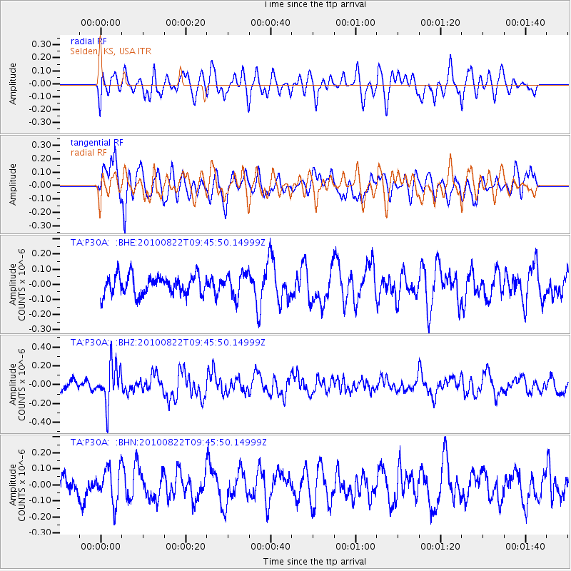
P30A Selden, KS, USA - Earthquake Result Viewer
*The percent match for this event was below the threshold and hence no stack was calculated.
| Earthquake location: |
Mariana Islands Region |
| Earthquake latitude/longitude: |
19.4/147.4 |
| Earthquake time(UTC): |
2010/08/22 (234) 09:33:06 GMT |
| Earthquake Depth: |
23 km |
| Earthquake Magnitude: |
5.9 MB, 5.3 MS, 5.5 MW |
| Earthquake Catalog/Contributor: |
WHDF/NEIC |
|
| Network: |
TA USArray Transportable Network (new EarthScope stations) |
| Station: |
P30A Selden, KS, USA |
| Lat/Lon: |
39.54 N/100.25 W |
| Elevation: |
788 m |
|
| Distance: |
93.9 deg |
| Az: |
45.78 deg |
| Baz: |
298.995 deg |
| Ray Param: |
$rayparam |
*The percent match for this event was below the threshold and hence was not used in the summary stack. |
|
| Radial Match: |
42.54638 % |
| Radial Bump: |
400 |
| Transverse Match: |
71.53187 % |
| Transverse Bump: |
400 |
| SOD ConfigId: |
319893 |
| Insert Time: |
2011-01-06 01:34:17.474 +0000 |
| GWidth: |
2.5 |
| Max Bumps: |
400 |
| Tol: |
0.001 |
|
Signal To Noise
| Channel | StoN | STA | LTA |
| TA:P30A: :BHZ:20100822T09:45:50.14999Z | 2.5970979 | 2.1253217E-7 | 8.1834486E-8 |
| TA:P30A: :BHN:20100822T09:45:50.14999Z | 1.382083 | 1.1009298E-7 | 7.9657276E-8 |
| TA:P30A: :BHE:20100822T09:45:50.14999Z | 1.2211765 | 7.6903085E-8 | 6.2974586E-8 |
| Arrivals |
| Ps | |
| PpPs | |
| PsPs/PpSs | |


