You are here: Home > Network List > IW - Intermountain West Stations List
> Station MOOW Moose Ponds, Wyoming, USA > Earthquake Result Viewer
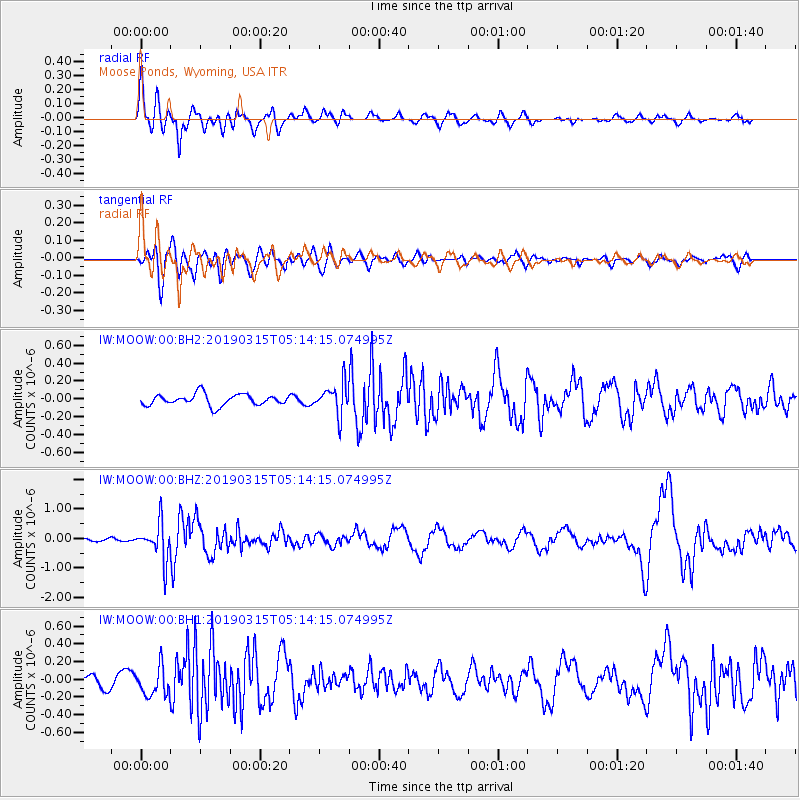
MOOW Moose Ponds, Wyoming, USA - Earthquake Result Viewer
*The percent match for this event was below the threshold and hence no stack was calculated.
| Earthquake location: |
Central Bolivia |
| Earthquake latitude/longitude: |
-17.9/-65.9 |
| Earthquake time(UTC): |
2019/03/15 (074) 05:03:50 GMT |
| Earthquake Depth: |
358 km |
| Earthquake Magnitude: |
6.3 Mww |
| Earthquake Catalog/Contributor: |
NEIC PDE/us |
|
| Network: |
IW Intermountain West |
| Station: |
MOOW Moose Ponds, Wyoming, USA |
| Lat/Lon: |
43.75 N/110.74 W |
| Elevation: |
2128 m |
|
| Distance: |
73.8 deg |
| Az: |
327.838 deg |
| Baz: |
135.607 deg |
| Ray Param: |
$rayparam |
*The percent match for this event was below the threshold and hence was not used in the summary stack. |
|
| Radial Match: |
67.61089 % |
| Radial Bump: |
400 |
| Transverse Match: |
69.621735 % |
| Transverse Bump: |
400 |
| SOD ConfigId: |
3338192 |
| Insert Time: |
2019-03-29 05:21:00.966 +0000 |
| GWidth: |
2.5 |
| Max Bumps: |
400 |
| Tol: |
0.001 |
|
Signal To Noise
| Channel | StoN | STA | LTA |
| IW:MOOW:00:BHZ:20190315T05:14:15.074995Z | 9.595772 | 6.333738E-7 | 6.600551E-8 |
| IW:MOOW:00:BH1:20190315T05:14:15.074995Z | 1.8094965 | 1.6189666E-7 | 8.947056E-8 |
| IW:MOOW:00:BH2:20190315T05:14:15.074995Z | 2.7372723 | 1.7248543E-7 | 6.3013616E-8 |
| Arrivals |
| Ps | |
| PpPs | |
| PsPs/PpSs | |


