You are here: Home > Network List > TA - USArray Transportable Network (new EarthScope stations) Stations List
> Station V34A Guthrie, OK, USA > Earthquake Result Viewer
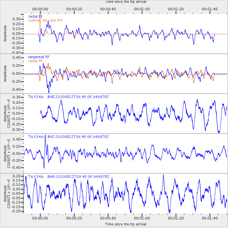
V34A Guthrie, OK, USA - Earthquake Result Viewer
*The percent match for this event was below the threshold and hence no stack was calculated.
| Earthquake location: |
Mariana Islands Region |
| Earthquake latitude/longitude: |
19.4/147.4 |
| Earthquake time(UTC): |
2010/08/22 (234) 09:33:06 GMT |
| Earthquake Depth: |
23 km |
| Earthquake Magnitude: |
5.9 MB, 5.3 MS, 5.5 MW |
| Earthquake Catalog/Contributor: |
WHDF/NEIC |
|
| Network: |
TA USArray Transportable Network (new EarthScope stations) |
| Station: |
V34A Guthrie, OK, USA |
| Lat/Lon: |
35.83 N/97.52 W |
| Elevation: |
329 m |
|
| Distance: |
97.6 deg |
| Az: |
47.933 deg |
| Baz: |
300.442 deg |
| Ray Param: |
$rayparam |
*The percent match for this event was below the threshold and hence was not used in the summary stack. |
|
| Radial Match: |
61.577873 % |
| Radial Bump: |
400 |
| Transverse Match: |
80.986626 % |
| Transverse Bump: |
400 |
| SOD ConfigId: |
319893 |
| Insert Time: |
2011-01-06 01:42:15.060 +0000 |
| GWidth: |
2.5 |
| Max Bumps: |
400 |
| Tol: |
0.001 |
|
Signal To Noise
| Channel | StoN | STA | LTA |
| TA:V34A: :BHZ:20100822T09:46:06.949978Z | 1.7790859 | 2.0555542E-7 | 1.1553991E-7 |
| TA:V34A: :BHN:20100822T09:46:06.949978Z | 1.2682974 | 9.262363E-8 | 7.30299E-8 |
| TA:V34A: :BHE:20100822T09:46:06.949978Z | 1.2555509 | 1.2159857E-7 | 9.684879E-8 |
| Arrivals |
| Ps | |
| PpPs | |
| PsPs/PpSs | |


