You are here: Home > Network List > CN - Canadian National Seismograph Network Stations List
> Station INK INUVIK, NT > Earthquake Result Viewer
INK INUVIK, NT - Earthquake Result Viewer
*The percent match for this event was below the threshold and hence no stack was calculated.
| Earthquake location: |
Near West Coast Of Honshu, Japan |
| Earthquake latitude/longitude: |
37.2/136.9 |
| Earthquake time(UTC): |
2024/01/01 (001) 07:18:42 GMT |
| Earthquake Depth: |
10 km |
| Earthquake Magnitude: |
6.2 mb |
| Earthquake Catalog/Contributor: |
NEIC PDE/us |
|
| Network: |
CN Canadian National Seismograph Network |
| Station: |
INK INUVIK, NT |
| Lat/Lon: |
68.31 N/133.53 W |
| Elevation: |
44 m |
|
| Distance: |
55.9 deg |
| Az: |
26.683 deg |
| Baz: |
285.316 deg |
| Ray Param: |
$rayparam |
*The percent match for this event was below the threshold and hence was not used in the summary stack. |
|
| Radial Match: |
49.271793 % |
| Radial Bump: |
400 |
| Transverse Match: |
51.670246 % |
| Transverse Bump: |
165 |
| SOD ConfigId: |
33437571 |
| Insert Time: |
2024-01-15 08:28:32.477 +0000 |
| GWidth: |
2.5 |
| Max Bumps: |
400 |
| Tol: |
0.001 |
|
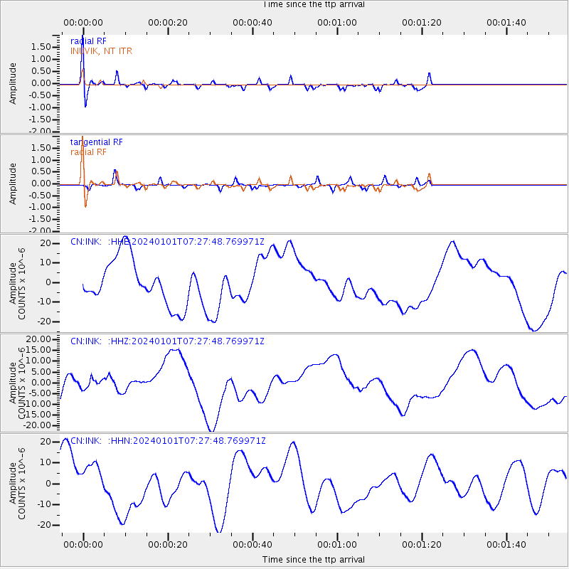
Signal To Noise
| Channel | StoN | STA | LTA |
| CN:INK: :HHZ:20240101T07:27:48.769971Z | 0.4023447 | 2.4493495E-6 | 6.087689E-6 |
| CN:INK: :HHN:20240101T07:27:48.769971Z | 1.2920953 | 9.508263E-6 | 7.3587935E-6 |
| CN:INK: :HHE:20240101T07:27:48.769971Z | 1.1884612 | 1.4009565E-5 | 1.1787987E-5 |
| Arrivals |
| Ps | |
| PpPs | |
| PsPs/PpSs | |


