You are here: Home > Network List > US - United States National Seismic Network Stations List
> Station HAWA Hanford, Washington, USA > Earthquake Result Viewer
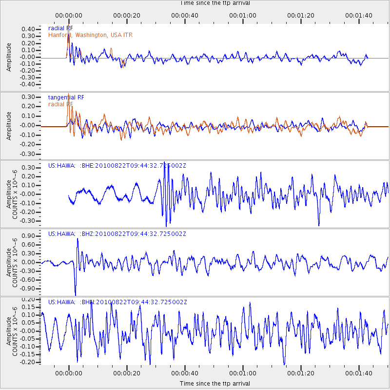
HAWA Hanford, Washington, USA - Earthquake Result Viewer
*The percent match for this event was below the threshold and hence no stack was calculated.
| Earthquake location: |
Mariana Islands Region |
| Earthquake latitude/longitude: |
19.4/147.4 |
| Earthquake time(UTC): |
2010/08/22 (234) 09:33:06 GMT |
| Earthquake Depth: |
23 km |
| Earthquake Magnitude: |
5.9 MB, 5.3 MS, 5.5 MW |
| Earthquake Catalog/Contributor: |
WHDF/NEIC |
|
| Network: |
US United States National Seismic Network |
| Station: |
HAWA Hanford, Washington, USA |
| Lat/Lon: |
46.39 N/119.53 W |
| Elevation: |
364 m |
|
| Distance: |
78.3 deg |
| Az: |
44.904 deg |
| Baz: |
285.746 deg |
| Ray Param: |
$rayparam |
*The percent match for this event was below the threshold and hence was not used in the summary stack. |
|
| Radial Match: |
57.439686 % |
| Radial Bump: |
400 |
| Transverse Match: |
52.40436 % |
| Transverse Bump: |
400 |
| SOD ConfigId: |
319893 |
| Insert Time: |
2011-01-06 01:47:36.127 +0000 |
| GWidth: |
2.5 |
| Max Bumps: |
400 |
| Tol: |
0.001 |
|
Signal To Noise
| Channel | StoN | STA | LTA |
| US:HAWA: :BHZ:20100822T09:44:32.725002Z | 5.2851458 | 3.9573422E-7 | 7.487669E-8 |
| US:HAWA: :BHN:20100822T09:44:32.725002Z | 1.5016952 | 8.40913E-8 | 5.599758E-8 |
| US:HAWA: :BHE:20100822T09:44:32.725002Z | 2.942822 | 1.7820788E-7 | 6.05568E-8 |
| Arrivals |
| Ps | |
| PpPs | |
| PsPs/PpSs | |


