You are here: Home > Network List > US - United States National Seismic Network Stations List
> Station AMTX Amarillo, Texas, USA > Earthquake Result Viewer
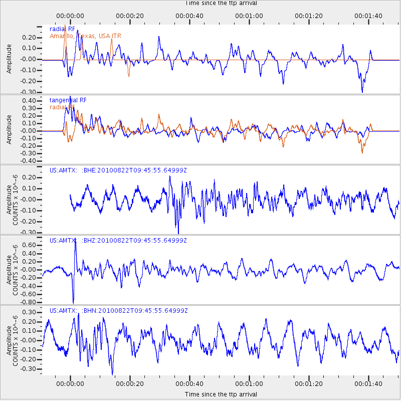
AMTX Amarillo, Texas, USA - Earthquake Result Viewer
*The percent match for this event was below the threshold and hence no stack was calculated.
| Earthquake location: |
Mariana Islands Region |
| Earthquake latitude/longitude: |
19.4/147.4 |
| Earthquake time(UTC): |
2010/08/22 (234) 09:33:06 GMT |
| Earthquake Depth: |
23 km |
| Earthquake Magnitude: |
5.9 MB, 5.3 MS, 5.5 MW |
| Earthquake Catalog/Contributor: |
WHDF/NEIC |
|
| Network: |
US United States National Seismic Network |
| Station: |
AMTX Amarillo, Texas, USA |
| Lat/Lon: |
34.53 N/101.41 W |
| Elevation: |
1010 m |
|
| Distance: |
95.5 deg |
| Az: |
50.639 deg |
| Baz: |
297.901 deg |
| Ray Param: |
$rayparam |
*The percent match for this event was below the threshold and hence was not used in the summary stack. |
|
| Radial Match: |
58.746872 % |
| Radial Bump: |
400 |
| Transverse Match: |
85.23218 % |
| Transverse Bump: |
400 |
| SOD ConfigId: |
319893 |
| Insert Time: |
2011-01-06 01:48:02.833 +0000 |
| GWidth: |
2.5 |
| Max Bumps: |
400 |
| Tol: |
0.001 |
|
Signal To Noise
| Channel | StoN | STA | LTA |
| US:AMTX: :BHZ:20100822T09:45:55.64999Z | 2.460531 | 3.038958E-7 | 1.2350823E-7 |
| US:AMTX: :BHN:20100822T09:45:55.64999Z | 1.0014533 | 1.4587467E-7 | 1.4566297E-7 |
| US:AMTX: :BHE:20100822T09:45:55.64999Z | 2.0437257 | 1.2172785E-7 | 5.9561735E-8 |
| Arrivals |
| Ps | |
| PpPs | |
| PsPs/PpSs | |


