You are here: Home > Network List > US - United States National Seismic Network Stations List
> Station HAWA Hanford, Washington, USA > Earthquake Result Viewer
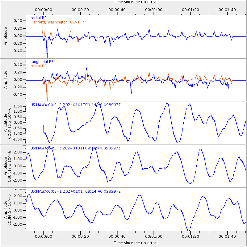
HAWA Hanford, Washington, USA - Earthquake Result Viewer
*The percent match for this event was below the threshold and hence no stack was calculated.
| Earthquake location: |
Near West Coast Of Honshu, Japan |
| Earthquake latitude/longitude: |
37.6/137.4 |
| Earthquake time(UTC): |
2024/01/01 (001) 09:03:49 GMT |
| Earthquake Depth: |
10 km |
| Earthquake Magnitude: |
5.5 mb |
| Earthquake Catalog/Contributor: |
NEIC PDE/us |
|
| Network: |
US United States National Seismic Network |
| Station: |
HAWA Hanford, Washington, USA |
| Lat/Lon: |
46.39 N/119.53 W |
| Elevation: |
364 m |
|
| Distance: |
71.7 deg |
| Az: |
45.233 deg |
| Baz: |
305.393 deg |
| Ray Param: |
$rayparam |
*The percent match for this event was below the threshold and hence was not used in the summary stack. |
|
| Radial Match: |
67.78301 % |
| Radial Bump: |
400 |
| Transverse Match: |
48.692703 % |
| Transverse Bump: |
400 |
| SOD ConfigId: |
33437571 |
| Insert Time: |
2024-01-15 09:34:12.055 +0000 |
| GWidth: |
2.5 |
| Max Bumps: |
400 |
| Tol: |
0.001 |
|
Signal To Noise
| Channel | StoN | STA | LTA |
| US:HAWA:00:BHZ:20240101T09:14:40.098997Z | 1.698466 | 1.9189652E-6 | 1.1298225E-6 |
| US:HAWA:00:BH1:20240101T09:14:40.098997Z | 0.5437582 | 6.8833873E-7 | 1.2658912E-6 |
| US:HAWA:00:BH2:20240101T09:14:40.098997Z | 1.4736961 | 1.3785495E-6 | 9.3543673E-7 |
| Arrivals |
| Ps | |
| PpPs | |
| PsPs/PpSs | |


