You are here: Home > Network List > CI - Caltech Regional Seismic Network Stations List
> Station DGR Domenigoni Reservoir, California, USA > Earthquake Result Viewer
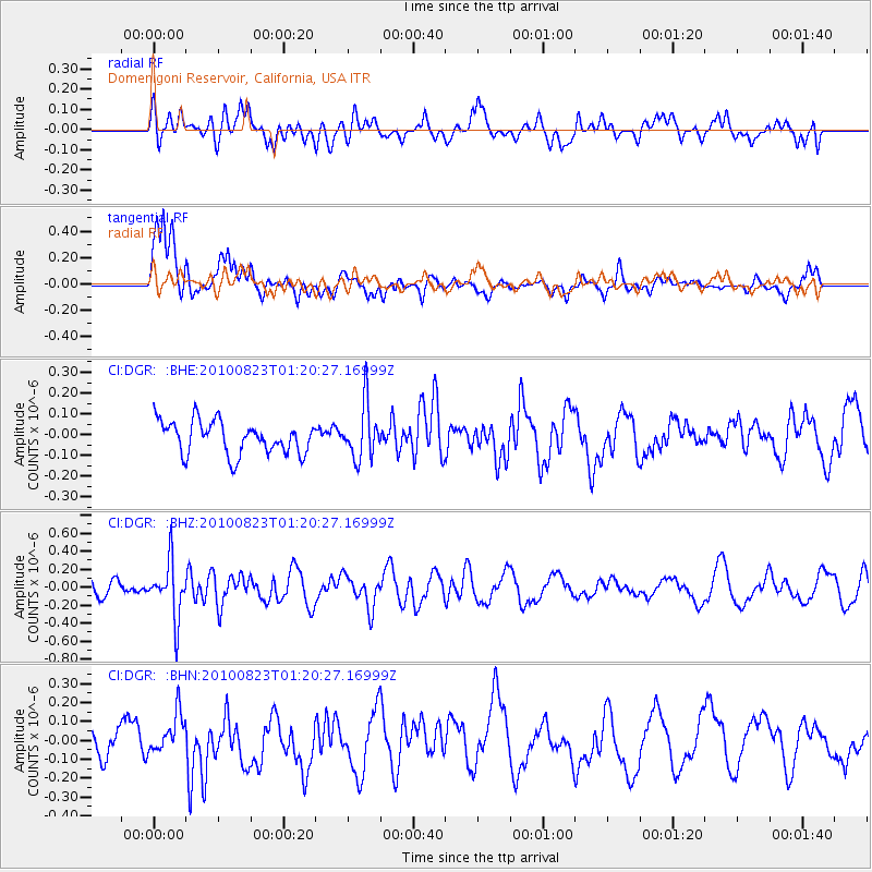
DGR Domenigoni Reservoir, California, USA - Earthquake Result Viewer
*The percent match for this event was below the threshold and hence no stack was calculated.
| Earthquake location: |
South Of Mariana Islands |
| Earthquake latitude/longitude: |
12.8/143.5 |
| Earthquake time(UTC): |
2010/08/23 (235) 01:08:09 GMT |
| Earthquake Depth: |
124 km |
| Earthquake Magnitude: |
5.6 MB, 5.5 MW |
| Earthquake Catalog/Contributor: |
WHDF/NEIC |
|
| Network: |
CI Caltech Regional Seismic Network |
| Station: |
DGR Domenigoni Reservoir, California, USA |
| Lat/Lon: |
33.65 N/117.01 W |
| Elevation: |
609 m |
|
| Distance: |
90.7 deg |
| Az: |
55.376 deg |
| Baz: |
285.785 deg |
| Ray Param: |
$rayparam |
*The percent match for this event was below the threshold and hence was not used in the summary stack. |
|
| Radial Match: |
51.147305 % |
| Radial Bump: |
400 |
| Transverse Match: |
77.43426 % |
| Transverse Bump: |
400 |
| SOD ConfigId: |
319893 |
| Insert Time: |
2011-01-06 01:56:51.699 +0000 |
| GWidth: |
2.5 |
| Max Bumps: |
400 |
| Tol: |
0.001 |
|
Signal To Noise
| Channel | StoN | STA | LTA |
| CI:DGR: :BHZ:20100823T01:20:27.16999Z | 3.613985 | 3.0779682E-7 | 8.516827E-8 |
| CI:DGR: :BHN:20100823T01:20:27.16999Z | 0.9248384 | 1.0380793E-7 | 1.1224439E-7 |
| CI:DGR: :BHE:20100823T01:20:27.16999Z | 1.6525275 | 1.3042795E-7 | 7.892634E-8 |
| Arrivals |
| Ps | |
| PpPs | |
| PsPs/PpSs | |


