You are here: Home > Network List > CI - Caltech Regional Seismic Network Stations List
> Station MPP McPhearson Peak > Earthquake Result Viewer
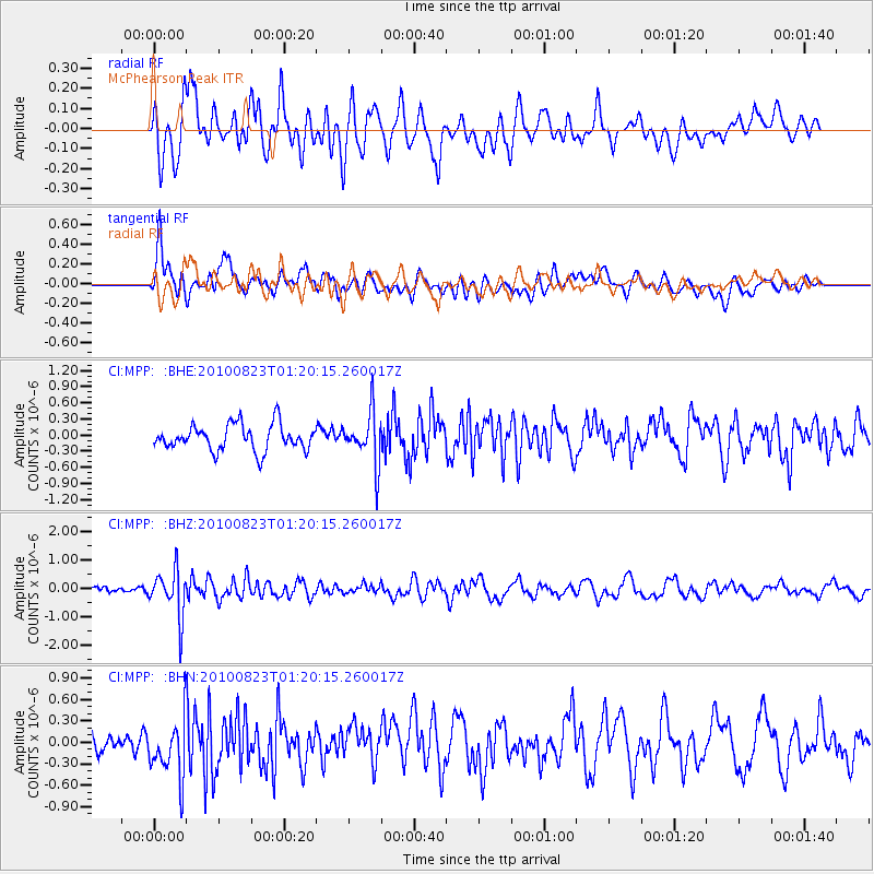
MPP McPhearson Peak - Earthquake Result Viewer
*The percent match for this event was below the threshold and hence no stack was calculated.
| Earthquake location: |
South Of Mariana Islands |
| Earthquake latitude/longitude: |
12.8/143.5 |
| Earthquake time(UTC): |
2010/08/23 (235) 01:08:09 GMT |
| Earthquake Depth: |
124 km |
| Earthquake Magnitude: |
5.6 MB, 5.5 MW |
| Earthquake Catalog/Contributor: |
WHDF/NEIC |
|
| Network: |
CI Caltech Regional Seismic Network |
| Station: |
MPP McPhearson Peak |
| Lat/Lon: |
34.89 N/119.81 W |
| Elevation: |
1739 m |
|
| Distance: |
88.1 deg |
| Az: |
54.784 deg |
| Baz: |
284.207 deg |
| Ray Param: |
$rayparam |
*The percent match for this event was below the threshold and hence was not used in the summary stack. |
|
| Radial Match: |
58.904575 % |
| Radial Bump: |
400 |
| Transverse Match: |
68.30454 % |
| Transverse Bump: |
400 |
| SOD ConfigId: |
319893 |
| Insert Time: |
2011-01-06 01:58:00.291 +0000 |
| GWidth: |
2.5 |
| Max Bumps: |
400 |
| Tol: |
0.001 |
|
Signal To Noise
| Channel | StoN | STA | LTA |
| CI:MPP: :BHZ:20100823T01:20:15.260017Z | 5.1662965 | 8.213867E-7 | 1.5898945E-7 |
| CI:MPP: :BHN:20100823T01:20:15.260017Z | 1.6163282 | 3.9807904E-7 | 2.4628602E-7 |
| CI:MPP: :BHE:20100823T01:20:15.260017Z | 1.983836 | 4.752309E-7 | 2.395515E-7 |
| Arrivals |
| Ps | |
| PpPs | |
| PsPs/PpSs | |


