You are here: Home > Network List > US - United States National Seismic Network Stations List
> Station MIAR Mount Ida, Arkansas, USA > Earthquake Result Viewer
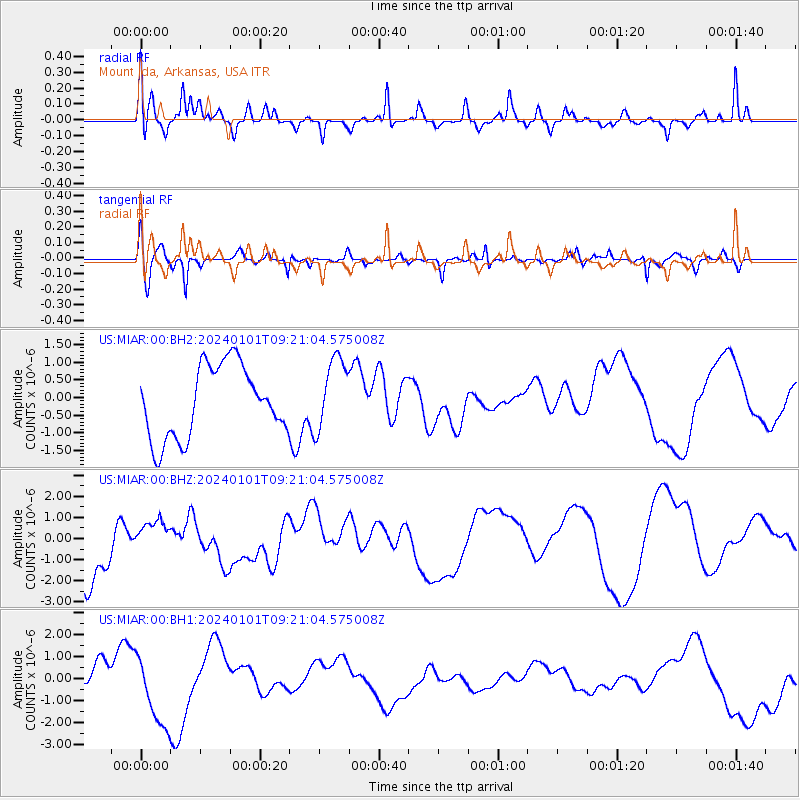
MIAR Mount Ida, Arkansas, USA - Earthquake Result Viewer
*The percent match for this event was below the threshold and hence no stack was calculated.
| Earthquake location: |
Near West Coast Of Honshu, Japan |
| Earthquake latitude/longitude: |
37.5/137.4 |
| Earthquake time(UTC): |
2024/01/01 (001) 09:08:17 GMT |
| Earthquake Depth: |
10 km |
| Earthquake Magnitude: |
5.6 mb |
| Earthquake Catalog/Contributor: |
NEIC PDE/us |
|
| Network: |
US United States National Seismic Network |
| Station: |
MIAR Mount Ida, Arkansas, USA |
| Lat/Lon: |
34.55 N/93.58 W |
| Elevation: |
207 m |
|
| Distance: |
94.1 deg |
| Az: |
40.013 deg |
| Baz: |
321.735 deg |
| Ray Param: |
$rayparam |
*The percent match for this event was below the threshold and hence was not used in the summary stack. |
|
| Radial Match: |
47.51872 % |
| Radial Bump: |
322 |
| Transverse Match: |
54.447285 % |
| Transverse Bump: |
316 |
| SOD ConfigId: |
33437571 |
| Insert Time: |
2024-01-15 10:01:12.573 +0000 |
| GWidth: |
2.5 |
| Max Bumps: |
400 |
| Tol: |
0.001 |
|
Signal To Noise
| Channel | StoN | STA | LTA |
| US:MIAR:00:BHZ:20240101T09:21:04.575008Z | 0.57489806 | 9.2671854E-7 | 1.6119701E-6 |
| US:MIAR:00:BH1:20240101T09:21:04.575008Z | 2.0773246 | 1.6974761E-6 | 8.1714535E-7 |
| US:MIAR:00:BH2:20240101T09:21:04.575008Z | 1.0226272 | 1.0369938E-6 | 1.0140486E-6 |
| Arrivals |
| Ps | |
| PpPs | |
| PsPs/PpSs | |


