You are here: Home > Network List > KN - Kyrgyz Seismic Telemetry Network Stations List
> Station TKM2 KN.TKM2 > Earthquake Result Viewer
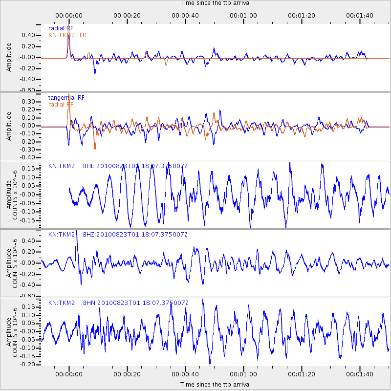
TKM2 KN.TKM2 - Earthquake Result Viewer
*The percent match for this event was below the threshold and hence no stack was calculated.
| Earthquake location: |
South Of Mariana Islands |
| Earthquake latitude/longitude: |
12.8/143.5 |
| Earthquake time(UTC): |
2010/08/23 (235) 01:08:09 GMT |
| Earthquake Depth: |
124 km |
| Earthquake Magnitude: |
5.6 MB, 5.5 MW |
| Earthquake Catalog/Contributor: |
WHDF/NEIC |
|
| Network: |
KN Kyrgyz Seismic Telemetry Network |
| Station: |
TKM2 KN.TKM2 |
| Lat/Lon: |
42.92 N/75.60 E |
| Elevation: |
2020 m |
|
| Distance: |
65.3 deg |
| Az: |
311.442 deg |
| Baz: |
95.479 deg |
| Ray Param: |
$rayparam |
*The percent match for this event was below the threshold and hence was not used in the summary stack. |
|
| Radial Match: |
42.55844 % |
| Radial Bump: |
369 |
| Transverse Match: |
61.608635 % |
| Transverse Bump: |
400 |
| SOD ConfigId: |
319893 |
| Insert Time: |
2011-01-06 02:02:04.275 +0000 |
| GWidth: |
2.5 |
| Max Bumps: |
400 |
| Tol: |
0.001 |
|
Signal To Noise
| Channel | StoN | STA | LTA |
| KN:TKM2: :BHZ:20100823T01:18:07.375007Z | 6.6182456 | 2.0026839E-7 | 3.026004E-8 |
| KN:TKM2: :BHN:20100823T01:18:07.375007Z | 1.3094482 | 4.6722537E-8 | 3.5681087E-8 |
| KN:TKM2: :BHE:20100823T01:18:07.375007Z | 1.3858327 | 1.16392975E-7 | 8.398776E-8 |
| Arrivals |
| Ps | |
| PpPs | |
| PsPs/PpSs | |


