You are here: Home > Network List > TA - USArray Transportable Network (new EarthScope stations) Stations List
> Station Y12C Blythe, CA, USA > Earthquake Result Viewer
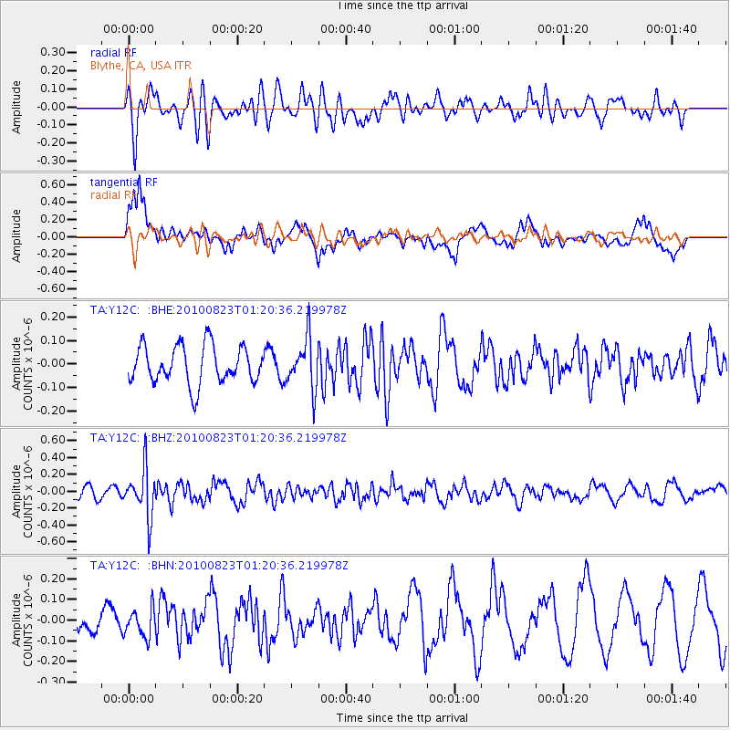
Y12C Blythe, CA, USA - Earthquake Result Viewer
*The percent match for this event was below the threshold and hence no stack was calculated.
| Earthquake location: |
South Of Mariana Islands |
| Earthquake latitude/longitude: |
12.8/143.5 |
| Earthquake time(UTC): |
2010/08/23 (235) 01:08:09 GMT |
| Earthquake Depth: |
124 km |
| Earthquake Magnitude: |
5.6 MB, 5.5 MW |
| Earthquake Catalog/Contributor: |
WHDF/NEIC |
|
| Network: |
TA USArray Transportable Network (new EarthScope stations) |
| Station: |
Y12C Blythe, CA, USA |
| Lat/Lon: |
33.75 N/114.52 W |
| Elevation: |
196 m |
|
| Distance: |
92.6 deg |
| Az: |
54.692 deg |
| Baz: |
287.177 deg |
| Ray Param: |
$rayparam |
*The percent match for this event was below the threshold and hence was not used in the summary stack. |
|
| Radial Match: |
49.363205 % |
| Radial Bump: |
400 |
| Transverse Match: |
69.95101 % |
| Transverse Bump: |
400 |
| SOD ConfigId: |
319893 |
| Insert Time: |
2011-01-06 02:03:15.394 +0000 |
| GWidth: |
2.5 |
| Max Bumps: |
400 |
| Tol: |
0.001 |
|
Signal To Noise
| Channel | StoN | STA | LTA |
| TA:Y12C: :BHZ:20100823T01:20:36.219978Z | 4.24483 | 2.9114548E-7 | 6.858825E-8 |
| TA:Y12C: :BHN:20100823T01:20:36.219978Z | 0.8919319 | 6.765208E-8 | 7.584894E-8 |
| TA:Y12C: :BHE:20100823T01:20:36.219978Z | 1.3397112 | 1.07750516E-7 | 8.0428165E-8 |
| Arrivals |
| Ps | |
| PpPs | |
| PsPs/PpSs | |


