You are here: Home > Network List > TA - USArray Transportable Network (new EarthScope stations) Stations List
> Station H25A Fruitdale, SD, USA > Earthquake Result Viewer
H25A Fruitdale, SD, USA - Earthquake Result Viewer
*The percent match for this event was below the threshold and hence no stack was calculated.
| Earthquake location: |
South Of Mariana Islands |
| Earthquake latitude/longitude: |
12.8/143.5 |
| Earthquake time(UTC): |
2010/08/23 (235) 01:08:09 GMT |
| Earthquake Depth: |
124 km |
| Earthquake Magnitude: |
5.6 MB, 5.5 MW |
| Earthquake Catalog/Contributor: |
WHDF/NEIC |
|
| Network: |
TA USArray Transportable Network (new EarthScope stations) |
| Station: |
H25A Fruitdale, SD, USA |
| Lat/Lon: |
44.62 N/103.60 W |
| Elevation: |
942 m |
|
| Distance: |
96.7 deg |
| Az: |
41.494 deg |
| Baz: |
295.176 deg |
| Ray Param: |
$rayparam |
*The percent match for this event was below the threshold and hence was not used in the summary stack. |
|
| Radial Match: |
48.55537 % |
| Radial Bump: |
400 |
| Transverse Match: |
50.013435 % |
| Transverse Bump: |
400 |
| SOD ConfigId: |
319893 |
| Insert Time: |
2011-01-06 02:06:05.677 +0000 |
| GWidth: |
2.5 |
| Max Bumps: |
400 |
| Tol: |
0.001 |
|
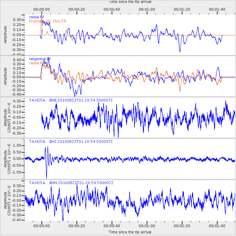
Signal To Noise
| Channel | StoN | STA | LTA |
| TA:H25A: :BHZ:20100823T01:20:54.500007Z | 4.4651203 | 4.9753646E-7 | 1.1142734E-7 |
| TA:H25A: :BHN:20100823T01:20:54.500007Z | 0.8861832 | 1.0337147E-7 | 1.1664797E-7 |
| TA:H25A: :BHE:20100823T01:20:54.500007Z | 1.1960489 | 1.2453968E-7 | 1.0412592E-7 |
| Arrivals |
| Ps | |
| PpPs | |
| PsPs/PpSs | |


