You are here: Home > Network List > TA - USArray Transportable Network (new EarthScope stations) Stations List
> Station G03D McMinnville, OR, USA > Earthquake Result Viewer
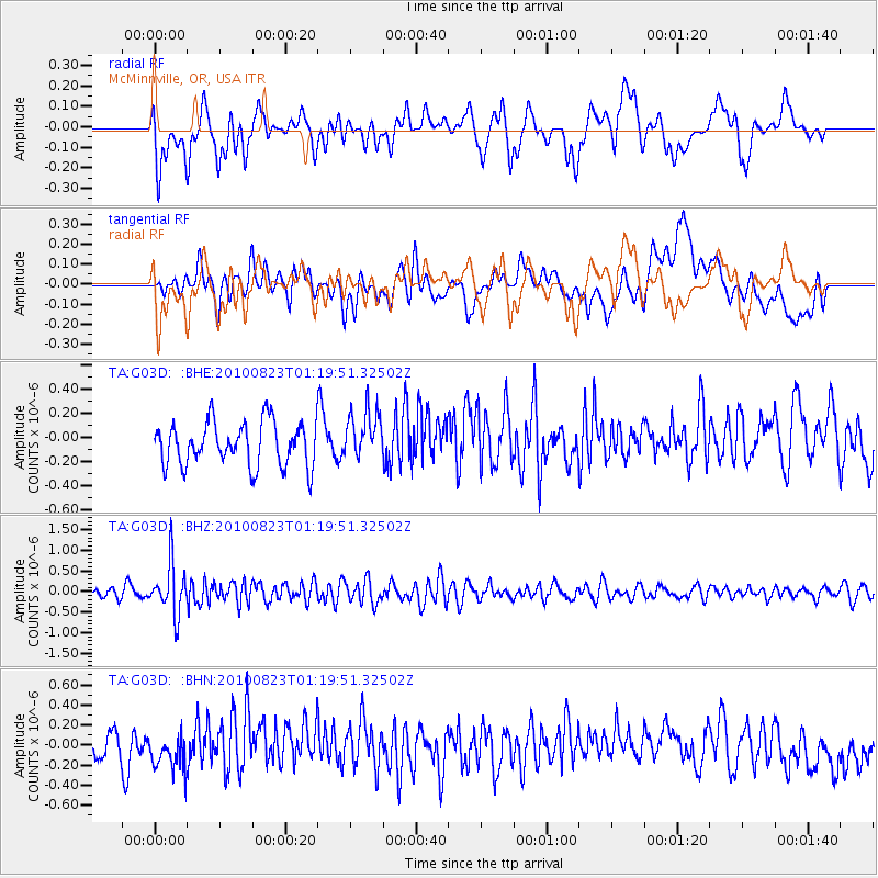
G03D McMinnville, OR, USA - Earthquake Result Viewer
*The percent match for this event was below the threshold and hence no stack was calculated.
| Earthquake location: |
South Of Mariana Islands |
| Earthquake latitude/longitude: |
12.8/143.5 |
| Earthquake time(UTC): |
2010/08/23 (235) 01:08:09 GMT |
| Earthquake Depth: |
124 km |
| Earthquake Magnitude: |
5.6 MB, 5.5 MW |
| Earthquake Catalog/Contributor: |
WHDF/NEIC |
|
| Network: |
TA USArray Transportable Network (new EarthScope stations) |
| Station: |
G03D McMinnville, OR, USA |
| Lat/Lon: |
45.21 N/123.26 W |
| Elevation: |
222 m |
|
| Distance: |
83.3 deg |
| Az: |
45.291 deg |
| Baz: |
281.27 deg |
| Ray Param: |
$rayparam |
*The percent match for this event was below the threshold and hence was not used in the summary stack. |
|
| Radial Match: |
55.288834 % |
| Radial Bump: |
400 |
| Transverse Match: |
55.67068 % |
| Transverse Bump: |
400 |
| SOD ConfigId: |
319893 |
| Insert Time: |
2011-01-06 02:08:33.677 +0000 |
| GWidth: |
2.5 |
| Max Bumps: |
400 |
| Tol: |
0.001 |
|
Signal To Noise
| Channel | StoN | STA | LTA |
| TA:G03D: :BHZ:20100823T01:19:51.32502Z | 4.0278187 | 6.094505E-7 | 1.5131032E-7 |
| TA:G03D: :BHN:20100823T01:19:51.32502Z | 1.3562088 | 1.7582555E-7 | 1.2964489E-7 |
| TA:G03D: :BHE:20100823T01:19:51.32502Z | 1.1412362 | 2.0712383E-7 | 1.8149078E-7 |
| Arrivals |
| Ps | |
| PpPs | |
| PsPs/PpSs | |


